लुइजियाना
| देय् | संयुक्त राज्य अमेरिका |
|---|---|
| Before statehood | |
| Admitted to the Union | April 30, 1812 (18th) |
| राजधानी | ब्यातन रुज, लुइजियाना |
| दकले तःधंगु नगर | न्यु अर्लिन्स[१][२][३] |
| Largest metro and urban areas | ग्रेतर न्यु अर्लिन्स |
| Government | |
| - गभर्नर | |
| - Lieutenant Governor | Jay Dardenne (R) |
| Population | |
| - Total | ४,६४९,६७६ (२,०१४ est)[४] |
| - Density | १०५/sq mi (४०.५/km2) |
| भाषा | |
| - Official language | अमेरिकन अंग्रेजी |
| - भाषा | As of 2007
|
| USPS abbreviation | |
| Latitude | 28° 56′ N to 33° 01′ N |
| Longitude | 88° 49′ W to 94° 03′ W |
लुइजियाना संयुक्त राज्य अमेरिकाया दक्षिणी भागय् अवस्थित छगू राज्य ख। थ्व राज्य संयुक्त राज्य अमेरिकाया ३१गू दकलय् तःधंगु व २५गू दकलय् अप्व जनसंख्या दूगु राज्य ख। थ्व राज्यया राजधानी ब्यातन रुज खः धाःसा दकलय् तःधंगु नगर न्यु अर्लिन्स खः। लुइजियाना संयुक्त राज्य अमेरिकाया छगू जक्क थन्याःगु राज्य खः गन "काउन्ति" धाःगु प्रशासनिक इकाइ मदु। काउन्तिया थासय् थ्व राज्यय् "प्यारिश" धाःगु प्रशासनिक इकाइ दु। जनसंख्या कथं थ्व राज्यया दकलय् तःधंगु प्यारिश इस्त ब्यातन रुज खः धाःसा क्षेत्रफल कथं दकलय् तःधंगु प्यारिश Plaquemines ख।
थ्व राज्यया आपाः बुं मिसिसिपि खुसिं चुइकाहःगु चां दयाच्वंगु दु। अथे जूगुलिं थ्व राज्यय् यक्व देल्ता व झ्वास्या बुं दु। [७] लुइजियानाय् निता स्वकुंलाःगु देल्ता दु। थुकिलि चिधंगु देल्ताया स्वकुं मोन्रो (वाशिता प्यारिशया प्यारिश सित), श्रिवेपोर्त(क्यादो प्यारिशया प्यारिश सित) व अलेक्जेन्द्रिया (Rapides प्यारिशया प्यारिश सित) नगरतेसं दयेकि धाःसा तःधंगु देल्ता मोन्रो, लेक चार्ल्स, व ल्यु अर्लिन्सं दयेकि। थ्व देल्ता दूगु थासय् भिंगु दक्षिणी बायोता (biota) दु। थ्व बायोताय् इबिस (ibis), इग्रेत (egret) आदि झंगः खनेदु। नापं, थ्व थासय् यक्व प्रजातिया सिमा ब्यां (tree frog), न्या दसु-sturgeon व प्यादलफिश (paddlefish) आदि प्राणीत नं म्वाइगु या। थ्व लागाया तःजाःगु थासय् लङ्गलिफ् पाइन जंगल व प्याःगु सभाना बुं दु। थ्व थासय् यक्व वनस्पतिया प्रजाति दसु-अर्किद मा व बमू मा (carnivorous plants) दयाच्वंगु दु।[७]
लुइजियानाया छुं नगरीय वातावरणय् बहुसांस्कृतिक, बहुभाषिक सम्पदा खनेछिं। थ्व थासय् १८गू शदी निसें फ्रेञ्च, स्पेनी, आदिवासी अमेरिकी, अफ्रिकी आदि तजिलजि ल्वाकज्यानाः छगू भिंगु तजिलजि बुयावःगु दु। सन् १८०३स संयुक्त राज्य अमेरिकां थ्व थाय् न्याये स्वया न्ह्यः थ्व थाय् फ्रेञ्च व स्पेनी उपनिवेशया रुपय् दयाच्वन। थ्व नापं उपनिवेशवादीतेसं अफ्रिकी मूलया दासतेत ज्यामिया रुपय् थन १८गू शदीइ आयात यात। थथे वैपिं दासय् यक्व पश्चिम अफ्रिकाया छगू हे थासं वःगुलिं इमिगु संस्कार छुं रुपय् म्वानाच्वन। अमेरिकाया गृहयुद्ध धुंकाया इलय् एङ्ग्लो अमेरिकनतेसं अंग्रेजीकरणया सांस्कृतिक दबाब बियाहःल व सन् १९१५स थ्व राज्यया आधिकारिक भाय् अंग्रेजी जक्क दयेकल।[८] लुइजियानाय् अमेरिकाया मेमेगु दक्षिणी राज्यय् स्वया अप्व आदिवासी अमेरिकनतेगु जाति दु। थन्याःगु जातिइ ४ता जाति संघीय रुपय् म्हसीकातःगु, १०ता जाति राज्यं म्हसीकातःगु दु धाःसा ४ता जातियात छुं नं स्तरय् म्हसीकातःगु मदु।[९]
प्यारिश
[सम्पादन]संयुक्त राज्य अमेरिकाया मेमेगु राज्यय् राज्ययात थीथी काउन्तिइ विभाजित यानातःगु दु। लुइजियानाय् धाःसा राज्ययात थीथी प्यारिशय् विभक्त यानातःगु दु। थ्व राज्यया प्यारिश थ्व कथं दु-
| अंग्रेजीइ नां [१०] |
प्यारिश (Parish) |
FIPS कोड [१०] |
प्यारिशया मुख्यालय [११] |
पलिस्था [११] |
उत्पत्ति |
नामाकरण [१२] |
जनसंख्या [११] |
क्षेत्रफल [११] |
मानकिपा
|
|---|---|---|---|---|---|---|---|---|---|
| Acadia | अकेदिया Parish | 001 | क्राउलि | 1886 | from part of St. Landry Parish. | Named for the Acadians who settled the area. | ६१,७७३ | ६५८ sq mi (१,७०४ km2) |

|
| Allen | एलेन Parish | 003 | Oberlin | 1912 | from part of Calcasieu Parish. | Henry Watkins Allen, the Confederate governor of Louisiana | २५,७६४ | ७६६ sq mi (१,९८४ km2) |

|
| Ascension | एसेन्सन (Ascension) Parish | 005 | दोनाल्दसन्भिल | 1807 | One of the original 19 parishes. | Named for the Ascension of Our Lord Catholic Church in Donaldsonville, Louisiana, which was named after the Ascension of Jesus into Heaven | १०७,२१५ | ३०३ sq mi (७८५ km2) |

|
| Assumption | एजम्प्सन Parish | 007 | नेपोलियनभिल | 1807 | One of the original 19 parishes. | Named for the Assumption Roman Catholic Church, the oldest in the state, which was named after the Assumption of the Virgin Mary | २३,४२१ | ३६४ sq mi (९४३ km2) |

|
| Avoyelles | Avoyelles Parish | 009 | मार्क्सभिल | 1807 | One of the original 19 parishes. | The Avoyel Native American people | ४२,०७३ | ८६६ sq mi (२,२४३ km2) |

|
| Beauregard | Beauregard Parish | 011 | DeRidder | 1912 | from part of Calcasieu Parish. | Confederate general P. G. T. Beauregard | ३५,६५४ | १,१६६ sq mi (३,०२० km2) |

|
| Bienville | बियनभिल Parish | 013 | आर्केदिया | 1848 | from part of Claiborne Parish. | Named after the founder of the city of New Orleans, Jean-Baptiste Le Moyne de Bienville | १४,३५३ | ८२२ sq mi (२,१२९ km2) |

|
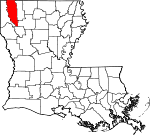
| Bossier | बोसियर Parish | 015 | बेन्तन | 1843 | from part Claiborne Parish. | U.S. Representative Pierre Bossier | ११६,९७९ | ८६७ sq mi (२,२४६ km2) |
|
| Caddo | क्यादो Parish | 017 | श्रिभ्पोर्त | 1838 | from part of Natchitoches Parish. | Named for the Caddo Native American people | २५४,९६९ | ९३७ sq mi (२,४२७ km2) |

|
| Calcasieu | Calcasieu Parish | 019 | लेक चार्ल्स | 1840 | from part of St. Landry Parish. | Calcasieu, meaning crying eagle, is said to be the name of an Atakapa Native American leader | १९२,७६८ | १,०९४ sq mi (२,८३३ km2) |

|
| Caldwell | काल्दवेल Parish | 021 | कोलम्बिया | 1838 | from part of Catahoula Parish and Ouachita Parish. | Named for the Caldwell family, which owned a large plantation and remains politically active in the state. | १०,१३२ | ५४१ sq mi (१,४०१ km2) |

|
| Cameron | क्यामेरन Parish | 023 | क्यामेरन | 1870 | from parts of Calcasieu Parish and Vermilion Parish. | U.S. Secretary of War Simon Cameron | ६,८३९ | १,९३२ sq mi (५,००४ km2) |

|
| Catahoula | Catahoula Parish | 025 | ह्यारिसनबर्ग | 1808 | from parts of Ouachita Parish and Rapides Parish. | Catahoula Lake, formerly within the parish's boundaries and named from a Taensa word meaning big, clear lake | १०,४०७ | ७३९ sq mi (१,९१४ km2) |

|
| Claiborne | क्लेबर्न Parish | 027 | होमर | 1828 | from part of Natchitoches Parish. | Governor of Louisiana William C. C. Claiborne | १७,१९५ | ७६८ sq mi (१,९८९ km2) |

|
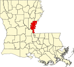
| Concordia | कंकर्दिया Parish | 029 | Vidalia | 1807 | One of the original 19 parishes. | Name is of uncertain origin; may be from an early land grant called New Concordia, from the "concord" reached by local authorities over a mutual surrender of slaves or for a mansion called Concord which was owned by Spanish Governor Manuel Gayoso de Lemos | २०,८२२ | ७४९ sq mi (१,९४० km2) |
|
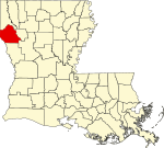
| De Soto | दे सोतो Parish | 031 | म्यान्स्फिल्द | 1843 | from parts of Caddo Parish and Natchitoches Parish. | Spanish explorer Hernando de Soto | २६,६५६ | ८९५ sq mi (२,३१८ km2) |
|
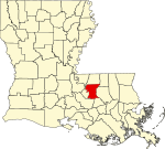
| East Baton Rouge | इस्त ब्यातन रुज Parish | 033 | ब्यातन रुज | 1810 | from West Florida territory. | French phrase bâton rouge meaning red stick. A red stick was used by local Native Americans to mark the boundaries between tribal territories | ४४०,१७१ | ४७१ sq mi (१,२२० km2) |
|
| East Carroll | इस्त क्यारल Parish | 035 | लेक प्रोभिदेन्स | 1877 | when Carroll Parish was divided. | Charles Carroll of Carrollton, the last surviving signer of the U.S. Declaration of Independence | ७,७५९ | ४४२ sq mi (१,१४५ km2) |

|
| East Feliciana | East Feliciana Parish | 037 | Clinton | 1824 | when Feliciana Parish was divided. | Felicite de Gálvez, the wife of Bernardo de Gálvez, a Spanish governor of Louisiana (New Spain) | २०,२६७ | ४५६ sq mi (१,१८१ km2) |

|
| Evangeline | इभ्याञ्जेलिन Parish | 039 | Ville Platte | 1910 | from part of St. Landry Parish. | Acadian heroine of the poem "Evangeline" by Henry Wadsworth Longfellow | ३३,९८४ | ६८० sq mi (१,७६१ km2) |

|
| Franklin | फ्र्याङ्क्लिन Parish | 041 | विन्सबोरो | 1843 | from parts of Carroll Parish, Catahoula Parish, Madison Parish and Ouachita Parish | Founding Father Benjamin Franklin | २०,७६७ | ६३६ sq mi (१,६४७ km2) |

|
| Grant | ग्रान्त Parish | 043 | कोल्फ्याक्स | 1869 | from parts of Rapides Parish and Winn Parish. | U.S. President Ulysses S. Grant | २२,३०९ | ६६४ sq mi (१,७२० km2) |

|
| Iberia | आइबेरिया Parish | 045 | न्यु आइबेरिया | 1868 | from parts of St. Martin Parish and St. Mary Parish. | Named by Spanish settlers in honor of the Iberian Peninsula | ७३,२४० | १,०३१ sq mi (२,६७० km2) |

|
| Iberville | आइबरभिल Parish | 047 | Plaquemine | 1807 | One of the original 19 parishes. | Explorer Pierre Le Moyne d'Iberville, the brother of Jean-Baptiste Le Moyne de Bienville | ३३,३८७ | ६५३ sq mi (१,६९१ km2) |

|
| Jackson | ज्याक्सन Parish | 049 | जोनेस्बरो | 1845 | from parts of Claiborne Parish, Ouachita Parish and Union Parish | U.S. President Andrew Jackson | १६,२७४ | ५८० sq mi (१,५०२ km2) |

|
| Jefferson | जेफर्सन Parish | 051 | ग्रेत्ना | 1825 | from part of Orleans Parish | Founding Father Thomas Jefferson | ४३२,५५२ | ६४२ sq mi (१,६६३ km2) |

|
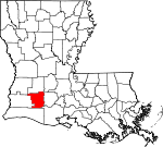
| Jefferson Davis | जेफर्सन देविस Parish | 053 | जेनिङ्ग्स् | 1912 | from part of Calcasieu Parish. | Jefferson Davis, president of the Confederate States of America | ३१,५९४ | ६५९ sq mi (१,७०७ km2) |
|
| Lafayette | लाफायेत Parish | 055 | लाफायेत | 1823 | from part of St. Martin Parish. | French-born American Revolutionary War hero, the Marquis de Lafayette | २२१,५७८ | २७० sq mi (६९९ km2) |

|
| Lafourche | Lafourche Parish | 057 | Thibodaux | 1807 | One of the original 19 parishes. Was named Interior Parish until 1812 and Lafourche Interior Parish until 1853. | French phrase la fourche or in English, the fork; Bayou Lafourche, or Fork Bayou, is a fork of the Mississippi River | ९६,३१८ | १,४७२ sq mi (३,८१२ km2) |

|
| La Salle | ला साल Parish | 059 | जेना | 1910 | from west half of Catahoula Parish. | Explorer René-Robert Cavelier, Sieur de La Salle | १४,८९० | ६६३ sq mi (१,७१७ km2) |

|
| Lincoln | लिङ्कन Parish | 061 | रस्तन | 1873 | from parts of Bienville Parish, Claiborne Parish, Jackson Parish and Union Parish. | U.S. President Abraham Lincoln | ४६,७३५ | ४७२ sq mi (१,२२२ km2) |

|
| Livingston | लिभिङ्गस्तन् Parish | 063 | लिभिङ्गस्तन् | 1832 | from part of St. Helena Parish. | U.S. Secretary of State Edward Livingston, brother of Robert R. Livingston who negotiated the Louisiana Purchase | १२८,०२६ | ७०३ sq mi (१,८२१ km2) |

|
| Madison | म्यादिसन Parish | 065 | तालुला | 1838 | from Concordia Parish. | U.S. President James Madison | १२,०९३ | ६५१ sq mi (१,६८६ km2) |

|
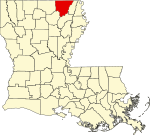
| Morehouse | मोरहाउस Parish | 067 | ब्यास्त्रप | 1844 | from parts of Carroll Parish and Ouachita Parish. | Abraham Morehouse, who led the first settlers into the region | २७,९७९ | ८०५ sq mi (२,०८५ km2) |
|
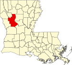
| Natchitoches | न्याकितोस् Parish | 069 | न्याकितोस् | 1807 | One of the original 19 parishes. | The Natchitoches Native American people | ३९,५६६ | १,२९९ sq mi (३,३६४ km2) |
|
| Orleans | अर्लिन्स Parish | 071 | न्यु अर्लिन्स | 1807 | One of the original 19 parishes. Today coterminous with the City of New Orleans. | Named after the Duke of Orléans, the regent of France | ३४३,८२९ | ३५० sq mi (९०६ km2) |

|
| Ouachita | वाशिता Parish | 073 | मन्रो | 1807 | One of the original 19 parishes. | The Ouachita Native American people | १५३,७२० | ६३३ sq mi (१,६३९ km2) |

|
| Plaquemines | Plaquemines Parish | 075 | Pointe a la Hache | 1807 | One of the original 19 parishes. | A word meaning persimmons created from the Louisiana Creole French and the Atakapa language | २३,०४२ | २,४२९ sq mi (६,२९१ km2) |

|
| Pointe Coupee | Pointe Coupee Parish | 077 | न्यु रोद्स् | 1807 | One of the original 19 parishes. | French phrase la pointe coupée or in English, the cut-off point, which refers to a bend in the Mississippi River | २२,८०२ | ५९१ sq mi (१,५३१ km2) |

|
| Rapides | Rapides Parish | 079 | अलेक्ज्यान्द्रिया | 1807 | One of the original 19 parishes. | Named for local river rapids (French: rapides) | १३१,६१३ | १,३६२ sq mi (३,५२८ km2) |

|
| Red River | रेद रिभर Parish | 081 | Coushatta | 1871 | from parts of Bienville Parish, Bossier Parish, Caddo Parish and Natchitoches Parish. | Named for the Red River, which is part of the Mississippi River watershed | ९,०९१ | ४०२ sq mi (१,०४१ km2) |

|
| Richland | रिचल्यान्द Parish | 083 | रेभिल | 1868 | from parts of Carroll Parish, Franklin Parish, Morehouse Parish and Ouachita Parish. | Named for its rich land | २०,७२५ | ५६४ sq mi (१,४६१ km2) |

|
| Sabine | Sabine Parish | 085 | Many | 1843 | from parts of Caddo Parish and Natchitoches Parish. | Named for the Sabine River and the so-called Sabine Free State | २४,२३३ | १,०१२ sq mi (२,६२१ km2) |

|
| Saint Bernard | सेन्त बर्नार्द Parish | 087 | Chalmette | 1807 | One of the original 19 parishes. | Saint Bernard, patron saint of Bernardo de Galvez, the Spanish governor who granted land to the Canary Islanders settling the area in 1778 | ३५,८९७ | १,७९४ sq mi (४,६४६ km2) |

|
| Saint Charles | सेन्त चार्ल्स Parish | 089 | Hahnville | 1807 | One of the original 19 parishes. | Saint Charles | ५२,७८० | ४१० sq mi (१,०६२ km2) |

|
| Saint Helena | सेन्त हेलेना Parish | 091 | ग्रीन्सबर्ग | 1810 | from West Florida territory. | Saint Helena | ११,२०३ | ४०९ sq mi (१,०५९ km2) |

|
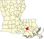
| Saint James | सेन्त जेम्स Parish | 093 | कन्भेन्त | 1807 | One of the original 19 parishes. | Saint James | २२,१०२ | २५८ sq mi (६६८ km2) |
|
| Saint John the Baptist | सेन्त जन द ब्याप्तिस्त Parish | 095 | एद्गार्द | 1807 | One of the original 19 parishes. | Saint John the Baptist | ४५,९२४ | ३४८ sq mi (९०१ km2) |

|
| Saint Landry | Saint Landry Parish | 097 | Opelousas | 1807 | One of the original 19 parishes. | Saint Landry | ८३,३८४ | ९३९ sq mi (२,४३२ km2) |

|
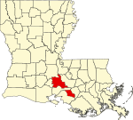
| Saint Martin | सेन्त मार्तिन Parish | 099 | Saint मार्तिनभिल | 1807 | One of the original 19 parishes. | Saint Martin | ५२,१६० | ८१७ sq mi (२,११६ km2) |
|
| Saint Mary | सेन्त मेरी Parish | 101 | फ्र्याङ्क्लिन | 1811 | from part of St. Martin Parish. | Saint Mary. | ५४,६५० | ६१२ sq mi (१,५८५ km2) |

|
| Saint Tammany | Saint Tammany Parish | 103 | कभिङ्तन | 1810 | from West Florida territory. | Legendary Indian Chief Tamanend. | २३३,७४० | १,१२४ sq mi (२,९११ km2) |

|
| Tangipahoa | Tangipahoa Parish | 105 | Amite | 1869 | from parts of Livingston Parish, St. Helena Parish, St. Tammany Parish and Washington Parish. | Comes from an Acolapissa word meaning ear of corn or those who gather corn | १२१,०९७ | ८२३ sq mi (२,१३२ km2) |

|
| Tensas | Tensas Parish | 107 | सेन्त जोसेफ | 1843 | from part of Concordia Parish. | The Taensa Native American people. | ५,०६६ | ६४१ sq mi (१,६६० km2) |

|
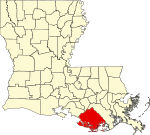
| Terrebonne | Terrebonne Parish | 109 | होमा | 1822 | from part of Lafourche Interior Parish. | French phrase terre bonne or in English, good earth | १११,८६० | २,०८० sq mi (५,३८७ km2) |
|
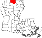
| Union | युनियन Parish | 111 | फार्मरभिल | 1839 | from part of Ouachita Parish. | Named for the union of states which make up the U.S. | २२,७२१ | ९०५ sq mi (२,३४४ km2) |
|
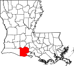
| Vermilion | Vermilion Parish | 113 | Abbeville | 1844 | from part of Lafayette Parish. | Both the Vermilion River and Vermilion Bay | ५७,९९९ | १,५३८ sq mi (३,९८३ km2) |
|
| Vernon | Vernon Parish | 115 | Leesville | 1871 | from parts of Natchitoches Parish, Rapides Parish and Sabine Parish. | Mount Vernon, the home of George Washington, the first U.S. President | ५२,३३४ | १,३४१ sq mi (३,४७३ km2) |

|
| Washington | वाशिङ्गतन Parish | 117 | फ्र्याङ्क्लिनतन | 1819 | from part of St. Tammany Parish. | U.S. President George Washington | ४७,१६८ | ६७६ sq mi (१,७५१ km2) |

|
| Webster | वेब्स्तर Parish | 119 | मिन्देन | 1871 | from parts of Bienville Parish, Bossier Parish and Claiborne Parish. | U.S. statesman Daniel Webster | ४१,२०७ | ६१५ sq mi (१,५९३ km2) |

|
| West Baton Rouge | वेस्त ब्यातन रुज Parish | 121 | पोर्त एलेन | 1807 | One of the original 19 parishes. Was named Baton Rouge Parish until 1812. | French phrase bâton rouge meaning red stick. A red stick was used by local Native Americans to mark the boundaries between tribal territories | २३,७८८ | २०३ sq mi (५२६ km2) |

|
| West Carroll | वेस्त क्यारल Parish | 123 | ओक ग्रोभ, वेस्त क्यारल प्यारिश | 1877 | when Carroll Parish was divided. | Charles Carroll of Carrollton, the last surviving signer of the U.S. Declaration of Independence | ११,६०४ | ३६० sq mi (९३२ km2) |

|
| West Feliciana | वेस्त फेलिसियाना Parish | 125 | सेन्त फ्रान्सिसभिल | 1824 | when Feliciana Parish was divided. | Felicite de Gálvez, the wife of Bernardo de Gálvez, a Spanish governor of Louisiana (New Spain) | १५,६२५ | १,०५१ sq mi (२,७२२ km2) |

|
| Winn | विन Parish | 127 | विनफिल्द | 1852 | from parts of Catahoula Parish, Natchitoches Parish and Rapides Parish. | Louisiana state legislator Walter Winn | १५,३१३ | ९५७ sq mi (२,४७९ km2) |

|
लिधंसा
[सम्पादन]- ↑ "New Orleans a 'ghost town' after thousands flee Gustav: mayor", AFP, Google, August 31, 2008, <http://afp.google.com/article/ALeqM5i4Io2zyj6VR8duSA6bXBGVt1H8Eg>[dead link]
- ↑ "Expert: N.O. population at 273,000", WWL-TV, August 7, 2007. Retrieved on August 14, 2007.[dead link]
- ↑ Relocation. Baton rouge. Connecting U.S. Cities (May 3, 2007).
- ↑ Cite error: Invalid
<ref>tag; no text was provided for refs namedPopEstUS - ↑ ५.० ५.१ Elevations and Distances in the United States. United States Geological Survey (2001). October 21, 2011 कथं।[dead link]
- ↑ ६.० ६.१ Elevation adjusted to North American Vertical Datum of 1988.
- ↑ ७.० ७.१ Keddy, Paul A. (2008). Water, Earth, Fire: Louisiana's Natural Heritage. Philadelphia: Xlibris.
- ↑ Alexander B. Murphy, "Placing Louisiana in the Francophone World: Opportunities and Challenges", first published in ''Atlantic Studies'' Volume 5, Issue 3, 2008; Special Issue: ''New Orleans in the Atlantic World, II'', (PDF). 2014-04-23 कथं।
- ↑ Dayna Bowker Lee, "Louisiana Indians in the 21st Century", Louisiana Folklife Program, 2013
- ↑ EPA County FIPS Code Listing. EPA.gov. 2008-02-23 कथं।
- ↑ ११.० ११.१ ११.२ ११.३ National Association of Counties. NACo - Find a county. मूलिधंसाय् तिथि 2008-06-04 कथं। 2008-06-12 कथं।
- ↑ Louisiana Dept. of Public Health Parish Profiles
स्वया दिसँ
[सम्पादन]स्वापू दुगु च्वसु
[सम्पादन]पिनेया स्वापूत
[सम्पादन]| विकिमिडिया मंका य् थ्व विषय नाप स्वापु दुगु मिडिया दु: Louisiana |
