| हेलेना, मोन्ताना |
| — नगर — |
|
|
| Nickname(s): Queen City of the Rockies, The Capital City |
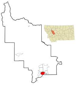 Location in Lewis and Clark County, MontanaLocation in Lewis and Clark County, Montana Location in Lewis and Clark County, MontanaLocation in Lewis and Clark County, Montana
|
| Coordinates: 46°35′44.9″N 112°1′37.31″W / 46.595806°N 112.0270306°W / 46.595806; -112.0270306 |
| Country |
United States |
| State |
मोन्ताना |
| County |
Lewis and Clark |
| पलिस्था |
अक्टोबर ३०, सन् १८६४ |
| Government |
| - Mayor |
James E. Smith |
| Area[१] |
| - नगर |
१६.३९ sq mi (४२.४५ km2) |
| - Land |
१६.३५ sq mi (४२.३५ km2) |
| - Water |
०.०४ sq mi (०.१० km2) |
| Elevation |
३,८७५ (Helena Regional Airport) ft (१,२३७ m) |
| Population (2010)[२] |
| - नगर |
२८,१९० |
| - Estimate (2011[३]) |
२८,५९२ |
| - Density |
१,७२४.२/sq mi (६६५.७/km2) |
| - Metro |
७४,८०१ |
| Time zone |
Mountain (UTC-7) |
| - Summer (DST) |
Mountain (UTC-6) |
| Area code(s) |
406 |
| FIPS code |
30-35600 |
| GNIS feature ID |
0802116 |
| Website |
www.ci.helena.mt.us |
हेलेना मोन्तानाया राजधानी ख। थ्व नगर समुद्र सतह स्वया १२३७ मितर च्वय् अवस्थित दु। थ्व नगरयात क्विन अफ रकिज (रकिजया लानि) नं धाइगु या।
| Climate data for Helena Airport (1981-2010 Normals), Montana
|
| Month
|
Jan
|
Feb
|
Mar
|
Apr
|
May
|
Jun
|
Jul
|
Aug
|
Sep
|
Oct
|
Nov
|
Dec
|
Year
|
| Record high °F (°C)
|
63
|
69
|
78
|
86
|
95
|
102
|
105
|
105
|
99
|
87
|
75
|
64
|
१०५
|
| Average high °F (°C)
|
32.6
|
37.8
|
47.6
|
57.1
|
66.5
|
75.0
|
85.1
|
83.8
|
72.0
|
58.1
|
42.4
|
31.1
|
५७.४
|
| Daily mean °F (°C)
|
22.6
|
27.1
|
35.8
|
44.5
|
53.5
|
61.6
|
69.6
|
67.9
|
57.4
|
45.2
|
32.0
|
21.4
|
४४.९
|
| Average low °F (°C)
|
12.6
|
16.4
|
24.1
|
31.9
|
40.6
|
48.2
|
54.0
|
51.9
|
42.7
|
32.3
|
21.7
|
11.7
|
३२.३
|
| Record low °F (°C)
|
−42
|
−42
|
−30
|
−10
|
17
|
30
|
36
|
28
|
6
|
−8
|
−39
|
−40
|
−४२
|
| Precipitation inches (mm)
|
0.36
|
0.30
|
0.59
|
0.97
|
1.87
|
2.06
|
1.19
|
1.20
|
1.10
|
0.65
|
0.49
|
0.39
|
११.१८
|
| Snowfall inches (cm)
|
5.9
|
5.1
|
5.6
|
3.5
|
0.9
|
0
|
0
|
0.3
|
1.1
|
2.1
|
4.1
|
6.8
|
३५.५
|
| Avg. precipitation days (≥ 0.01 in)
|
6.2
|
5.9
|
7.7
|
8.7
|
11.1
|
11.2
|
7.7
|
7.3
|
6.1
|
6.2
|
6.9
|
6.6
|
९१.६
|
| Avg. snowy days (≥ 0.1 in)
|
5.3
|
4.9
|
4.5
|
2.7
|
0.8
|
0.1
|
0
|
0.1
|
0.6
|
1.6
|
4.0
|
5.8
|
३०.४
|
| Mean monthly sunshine hours
|
120.9
|
149.7
|
226.3
|
243.0
|
282.1
|
309.0
|
368.9
|
325.5
|
255.0
|
201.5
|
120.0
|
99.2
|
२,७०१.१
|
| Source #1: NOAA (normals 1981−2010)[४], Hong Kong Observatory (sun, 1961-1990)[५]
|
| Source #2: The Weather Channel (records, 1880-present)[६]
|
| Historical populations
|
| Census |
Pop. |
|
%±
|
| 1870 | ३,१०६ | | — |
| 1880 | ३,६२४ | | 16.7% |
| 1890 | १३,८३४ | | 281.7% |
| 1900 | १०,७७० | | −22.1% |
| 1910 | १२,५१५ | | 16.2% |
| 1920 | १२,०३७ | | −3.8% |
| 1930 | ११,८०३ | | −1.9% |
| 1940 | १५,०५६ | | 27.6% |
| 1950 | १७,५८१ | | 16.8% |
| 1960 | २०,२२७ | | 15.1% |
| 1970 | २२,७३० | | 12.4% |
| 1980 | २३,९३८ | | 5.3% |
| 1990 | २४,५६९ | | 2.6% |
| 2000 | २५,७८० | | 4.9% |
| 2010 | २८,१९० | | 9.3% |
| source:[७][८] |


