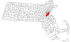
बस्तन
Appearance
| बस्टन | |||
|---|---|---|---|
| — State Capital — | |||
| बस्टनया नगर | |||
 |
|||
|
|||
| Nickname(s): Beantown,[१] The Hub (of the Universe),[१] The Cradle of Liberty,[२] The Cradle of Modern America,[१] The Athens of America,[२] The Walking City[१] | |||
| Motto: Sicut patribus sit Deus nobis (Latin "As God was with our fathers, so may He be with us") | |||
 |
|||
| Coordinates: 42°21′29″N 71°03′49″W / 42.35806°N 71.06361°WCoordinates: 42°21′29″N 71°03′49″W / 42.35806°N 71.06361°W | |||
| Present Country | United States | ||
| Historic Country | England | ||
| State | म्यासेच्युसेट्स | ||
| Historic Colony | Colony of Massachusetts Bay | ||
| County | Suffolk | ||
| Settled (town) | September 17, 1630 | ||
| Incorporated (city) | March 4, 1822 | ||
| Government | |||
| - Type | Strong mayor – council | ||
| - Mayor | Thomas M. Menino (D) | ||
| Area[३][४][५] | |||
| - State Capital | ८९.६३ sq mi (२३२.१४ km2) | ||
| - Land | ४८.४३ sq mi (१२५.४३ km2) | ||
| - Water | ४१.२१ sq mi (१०६.७३ km2) | ||
| - Urban | १,७७४ sq mi (४,५९५ km2) | ||
| - Metro | ४,५११ sq mi (११,६८३ km2) | ||
| - CSA | १०,६४४ sq mi (२७,५६८ km2) | ||
| Elevation | १४१ ft (४३ m) | ||
| Population [६][७][८][९][१०] | |||
| - State Capital | ६२५,०८७ ('११ est.) | ||
| - Density | १२,७५२/sq mi (४,९२४/km2) | ||
| - Urban | ४,०३२,४८४ ('०० census) | ||
| - Metro | ४,५२२,८५८ ('०८ est.) | ||
| - CSA | ७,६०९,३५८ ('०९ est.) | ||
| - नां | बस्टनियन | ||
| Time zone | EST (UTC-5) | ||
| - Summer (DST) | EDT (UTC-4) | ||
| ZIP code(s) | 53 total ZIP codes:[११]
|
||
| Area code(s) | 617 and 857 | ||
| FIPS code | 25-07000 | ||
| GNIS feature ID | 0617565 | ||
| Website | cityofboston.gov | ||
बस्टन म्यासेच्युसेट्सया राजधानी ख।
लिधंसा
[सम्पादन]- ↑ १.० १.१ १.२ १.३ Cite error: Invalid
<ref>tag; no text was provided for refs namedNicknames1 - ↑ २.० २.१ Boston Travel & Vacations. Britannia.com (2006). April 8, 2009 कथं।
- ↑ Massachusetts by Place and County Subdivision. United States Census Bureau. April 29, 2009 कथं।[dead link]
- ↑ United States by Urbanized Area; and for Puerto Rico. United States Census Bureau. April 29, 2009 कथं।[dead link]
- ↑ United States by County by State, and for Puerto Rico. United States Census Bureau. April 29, 2009 कथं।[dead link]
- ↑ Cite error: Invalid
<ref>tag; no text was provided for refs named2010census - ↑ Cite error: Invalid
<ref>tag; no text was provided for refs namedquickfacts - ↑ Alphabetically sorted list of Census 2000 Urbanized Areas (TXT). United States Census Bureau, Geography Division. April 11, 2009 कथं।
- ↑ Cite error: Invalid
<ref>tag; no text was provided for refs namedMetro population - ↑ Cite error: Invalid
<ref>tag; no text was provided for refs namedCSA population - ↑ ZIP Code Lookup – Search By City. United States Postal Service. April 20, 2009 कथं।
स्वयादिसँ
[सम्पादन]| विकिमिडिया मंका य् थ्व विषय नाप स्वापु दुगु मिडिया दु: Boston |


