फ्लोरिदाया काउन्तितेगु धलः
Appearance

फ्लोरिदाय् ६७गु काउन्तीत दु। थ्व राज्यया काउन्तीत थ्व कथं दु-
काउन्तीत
[सम्पादन]| अंग्रेजीइ नां [१] |
काउन्टी |
FIPS कोड [१] |
काउन्ती सित [२] |
पलिस्था [३] |
Formed from [३] |
इतिमोलोजी [३] |
जनघनत्त्व |
जनसंख्या [४] |
क्षेत्रफल [५][२] |
मानकिपा |
|---|---|---|---|---|---|---|---|---|---|---|
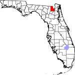
| Alachua | आलाचुआ काउन्ति | 001 | गाइन्सभिल | सन् १८२४ | सेन्त जन्स् काउन्ति | थ्व काउन्तिया नां उत्तरपूर्व गाइन्स्भिलय् दयाच्वंगु गल्छि(खाइ)या आदिवासी अमेरिकी नामं बुयावःगु ख। | 285.31 | २४९,३६५ | ८७४ sq mi (२,२६४ km2) |

|
| Baker | बेकर काउन्ति | 003 | म्याकक्लेनी, फ्लोरिडा | सन् १८६१ | ब्रादफर्द काउन्ति | जेम्स् मिक्नेर बेकर (सन् १८२१-सन् १८९२), कन्फेदरेत सिनेतर व लिपा ४गु ज्युदिसियल दिस्त्रिक्तया न्यायाधीश। | 46.42 | २७,१५४ | ५८५ sq mi (१,५१५ km2) |
|
| Bay | बे काउन्ति | 005 | पनामा सिटी, फ्लोरिडा | 1913 | Washington County | St. Andrew's Bay, the central geographic feature of the county | 222.32 | १६९,८५६ | ७६४ sq mi (१,९७९ km2) |

|
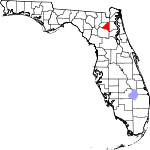
| Bradford | ब्रादफर्द काउन्ति | 007 | स्टार्की, फ्लोरिडा | 1858 | Columbia and Alachua counties | Richard Bradford, the first officer from Florida to die in the Civil War; he was killed during the Battle of Santa Rosa Island | 96.43 | २८,२५५ | २९३ sq mi (७५९ km2) |
|
| Brevard | ब्रेभार्द काउन्ति | 009 | टाइटसभिल, फ्लोरिडा | 1855 | St. Lucie County was renamed Brevard, and small parts of Orange County, and Volusia were ceded[६] | Theodore Washington Brevard, early settler and later state comptroller from 1853 to 1861[६] | 533.95 | ५४३,५६६ | १,०१८ sq mi (२,६३७ km2) |

|
| Broward | ब्रोवार्द काउन्ति | 011 | फर्ट लाउदरदेल, फ्लोरिडा | 1915 | Miami-Dade County | Napoleon Bonaparte Broward (1857–1910), 19th Governor of Florida from 1905 to 1909 | 1472.43 | १,७८०,१७२ | १,२०९ sq mi (३,१३१ km2) |

|
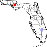
| Calhoun | क्याल्हुन काउन्ति | 013 | ब्लाउन्ट्सटाउन, फ्लोरिडा | 1838 | Escambia County | John C. Calhoun (1782–1850) leading Southern politician from South Carolina | 26.01 | १४,७५० | ५६७ sq mi (१,४६९ km2) |
|
| Charlotte | शार्लत काउन्ति | 015 | पुन्टा गोर्डा, फ्लोरिडा | 1921 | DeSoto County | Probably a corruption of the name of the Calusa, a group of Native Americans from the area | 231.28 | १६०,५११ | ६९४ sq mi (१,७९७ km2) |

|
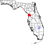
| Citrus | साइत्रस काउन्ति | 017 | इन्भर्नेस्, फ्लोरिदा | 1887 | Hernando County | The county's citrus trees | 239.78 | १४०,०३१ | ५८४ sq mi (१,५१३ km2) |
|
| Clay | क्ले काउन्ति | 019 | ग्रीन कोभ स्प्रिङ्गस्, फ्लोरिडा | 1858 | Duval County | Henry Clay (1777–1852), Secretary of State from 1825 to 1829 under John Quincy Adams | 320.08 | १९२,३७० | ६०१ sq mi (१,५५७ km2) |

|
| Collier | कोलियर काउन्ति | 021 | नेपल्स, फ्लोरिडा | 1923 | Lee County | Barron Collier (1873–1939), an advertising entrepreneur who developed much of the land in southern Florida | 161.96 | ३२८,१३४ | २,०२६ sq mi (५,२४७ km2) |

|
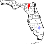
| Columbia | कोलम्बिया काउन्ति | 023 | लेक सिटी, फ्लोरिडा | 1832 | St. Johns County | Christopher Columbus (c. 1451–1506), explorer of the Americas | 84.67 | ६७,४८५ | ७९७ sq mi (२,०६४ km2) |
|
| DeSoto | देसोतो काउन्ति | 027 | आर्काडिया, फ्लोरिडा | 1887 | Manatee County | Hernando de Soto (c. 1496/1497–1542), a Spanish explorer and conquistador | 54.78 | ३४,८९४ | ६३७ sq mi (१,६५० km2) |

|
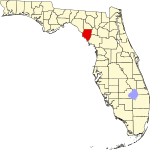
| Dixie | दिक्सि काउन्ति | 029 | क्रस सिटी, फ्लोरिडा | 1921 | Lafayette County | Dixie, the common nickname for the Southern United States | 23.42 | १६,४८६ | ७०४ sq mi (१,८२३ km2) |
|
| Duval | दुभाल काउन्ति | 031 | ज्याकसनभिल, फ्लोरिडा | 1822 | St. Johns County | William Pope Duval (1784–1854), the first governor of the Florida Territory | 1124.95 | ८७०,७०९ | ७७४ sq mi (२,००५ km2) |

|
| Escambia | एस्काम्बिया काउन्ति | 033 | पेन्साकोला, फ्लोरिडा | 1821 | One of the two original counties of Florida | Disputed origin; possibly from the Native American word Shambia, meaning "clear water" | 450.47 | २९९,११४ | ६६४ sq mi (१,७२० km2) |

|
| Flagler | फ्लाग्लर काउन्ति | 035 | ब्युनेल, फ्लोरिडा | 1917 | St. Johns and Volusia counties | Henry Morrison Flagler (1830–1913), founder of the Florida East Coast Railway | 200.78 | ९७,३७६ | ४८५ sq mi (१,२५६ km2) |

|
| Franklin | फ्र्याङ्क्लिन काउन्ति | 037 | एपालाचिकोला, फ्लोरिडा | 1832 | Escambia County | Benjamin Franklin (1706–1790), one of the Founding Fathers of the United States of America | 21.72 | ११,५९६ | ५३४ sq mi (१,३८३ km2) |

|
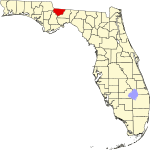
| Gadsden | गाद्स्देन काउन्ति | 039 | क्विन्सी, फ्लोरिडा | 1823 | Jackson County | James Gadsden (1788–1858), American diplomat and namesake of the Gadsden Purchase | 89.44 | ४६,१५१ | ५१६ sq mi (१,३३६ km2) |
|
| Gilchrist | गिल्क्रिस्त काउन्ति | 041 | ट्रेन्टन, फ्लोरिडा | 1925 | Alachua County | Albert W. Gilchrist (1858–1926), the 20th Governor of Florida | 48.72 | १७,००४ | ३४९ sq mi (९०४ km2) |

|
| Glades | ग्लेद्स काउन्ति | 043 | मूर ह्याभेन, फ्लोरिडा | 1921 | DeSoto County | The Florida Everglades | 16.32 | १२,६३५ | ७७४ sq mi (२,००५ km2) |

|
| Gulf | गल्फ काउन्ति | 045 | पोर्त सेन्त जो, फ्लोरिदा | 1925 | Calhoun County | The Gulf of Mexico | 28.04 | १५,८४४ | ५६५ sq mi (१,४६३ km2) |

|
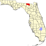
| Hamilton | ह्यामिल्तन काउन्ति | 047 | ज्यास्पर, फ्लोरिडा | 1827 | Escambia County | Alexander Hamilton (1757–1804), the first United States Secretary of the Treasury and a Founding Father | 28.49 | १४,६७१ | ५१५ sq mi (१,३३४ km2) |
|
| Hardee | हार्दि काउन्ति | 049 | वौचुला, फ्लोरिडा | 1921 | DeSoto County | Cary A. Hardee (1876–1957), governor of Florida at the time of creation of Hardee County | 43.78 | २७,८८७ | ६३७ sq mi (१,६५० km2) |

|
| Hendry | हेन्द्रि काउन्ति | 051 | लाबेले, फ्लोरिडा | 1923 | Lee County | Francis A. Hendry (1833–1917), early Floridian pioneer and politician | 33.90 | ३९,०८९ | १,१५३ sq mi (२,९८६ km2) |

|
| Hernando | हर्न्यान्दो काउन्ति | 053 | ब्रुक्स्भिल्, फ्लोरिदा | 1843 | Hillsborough, Mosquito, and Alachua counties | Hernando de Soto (c.1496/1497–1542), a Spanish explorer and conquistador | 362.12 | १७३,०९४ | ४७८ sq mi (१,२३८ km2) |

|
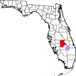
| Highlands | हाइल्यान्द्स काउन्ति | 055 | सेब्रिंग, फ्लोरिडा | 1921 | DeSoto County | Named for the county's hilly terrain | 95.94 | ९८,६३० | १,०२८ sq mi (२,६६३ km2) |
|
| Hillsborough | हिल्स्बरो काउन्ति | 057 | ताम्पा, फ्लोरिदा | 1834 | Alachua and Monroe | Wills Hill, 1st Marquess of Downshire (1718–1793), former Secretary of State of the American Colonies | 1206.26 | १,२६७,७७५ | १,०५१ sq mi (२,७२२ km2) |

|
| Holmes | होम्स काउन्ति | 059 | बोनिफे, फ्लोरिडा | 1848 | Jackson and Walton counties | Holmes Creek, which forms the eastern boundary of the county | 41.23 | १९,८७३ | ४८२ sq mi (१,२४८ km2) |

|
| Indian River | इन्दियन रिभर काउन्ति | 061 | भेरो बीच, फ्लोरिडा | 1925 | St. Lucie County | The Indian River Lagoon, which flows through the county | 276.13 | १३८,८९४ | ५०३ sq mi (१,३०३ km2) |

|
| Jackson | ज्याक्सन काउन्ति | 063 | मारियाना, फ्लोरिडा | 1822 | Escambia County | Andrew Jackson (1767–1845), the seventh President of the United States | 53.81 | ४९,२९२ | ९१६ sq mi (२,३७२ km2) |

|
| Jefferson | जेफर्सन काउन्ति | 065 | मोन्टिसेलो, फ्लोरिडा | 1827 | Escambia County | Thomas Jefferson (1743–1826), the third President of the United States and principal author of the Declaration of Independence | 24.51 | १४,६५८ | ५९८ sq mi (१,५४९ km2) |

|
| Lafayette | लाफायेत काउन्ति | 067 | मायो, फ्लोरिडा | 1856 | Madison County | Marquis de Lafayette (1757–1834), French aristocrat and general in the American Revolutionary War | 16.47 | ८,९४२ | ५४३ sq mi (१,४०६ km2) |

|
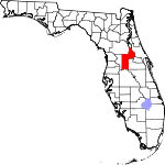
| Lake | लेक काउन्ति | 069 | ट्याभारेज, फ्लोरिडा | 1887 | Orange and Sumter counties | Named for the many lakes in the region | 315.86 | ३०१,०१९ | ९५३ sq mi (२,४६८ km2) |
|
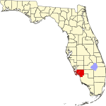
| Lee | ली काउन्ति | 071 | फर्ट मायर्स, फ्लोरिडा | 1887 | Monroe County | Robert E. Lee (1807–1870), commander of the Confederate Army of Northern Virginia in the American Civil War | 785.24 | ६३१,३३० | ८०४ sq mi (२,०८२ km2) |
|
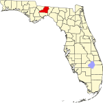
| Leon | लिअन काउन्ति | 073 | तालाहासे, फ्लोरिदा | 1824 | Escambia County | Juan Ponce de León (1474–1521), Spanish explorer who named Florida | 416.75 | २७७,९७१ | ६६७ sq mi (१,७२८ km2) |
|
| Levy | लेभी काउन्ति | 075 | ब्रोन्सन, फ्लोरिडा | 1845 | Alachua County | David Levy Yulee (1810–1886), one of the state's original United States Senators | 35.92 | ४०,१५६ | १,११८ sq mi (२,८९६ km2) |

|
| Liberty | लिबर्ति काउन्ति | 077 | ब्रिस्टल, फ्लोरिडा | 1855 | Gadsden County | The patriotic ideal of liberty | 9.94 | ८,३१४ | ८३६ sq mi (२,१६५ km2) |

|
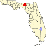
| Madison | म्यादिसन काउन्ति | 079 | Madison | 1827 | Jefferson County | James Madison (1751–1836), fourth President of the United States | 27.62 | १९,११५ | ६९२ sq mi (१,७९२ km2) |
|
| Manatee | मानाति काउन्ति | 081 | ब्राडेनटन, फ्लोरिडा | 1855 | Hillsborough and Orange counties | The Manatee, or sea cow, is native to Floridian waters | 441.49 | ३२७,१४२ | ७४१ sq mi (१,९१९ km2) |

|
| Marion | मेरियन काउन्ति | 083 | ओकाला, फ्लोरिडा | 1844 | Alachua and Orange counties | Francis Marion (c. 1732–1795), military officer during the American Revolution | 210.59 | ३३२,५२९ | १,५७९ sq mi (४,०९० km2) |

|
| Martin | मार्तिन काउन्ति | 085 | स्टुआर्ट, फ्लोरिडा | 1925 | St. Lucie and Palm Beach counties | John W. Martin (1884–1958), governor of Florida at time of creation of the county | 265.28 | १४७,४९५ | ५५६ sq mi (१,४४० km2) |

|
| Miami-Dade | मायामी-देद काउन्ति | 086 | मायामी, फ्लोरिडा | 1836 | St. Johns County | City of Miami and Francis L. Dade (c. 1793–1835), Major in the United States Army during the Second Seminole War | 1313.50 | २,५५४,७६६ | १,९४५ sq mi (५,०३८ km2) |

|
| Monroe | मोन्रो काउन्ति | 087 | की वेस्ट, फ्लोरिडा | 1823 | St. Johns County | James Monroe (1758–1831), fifth President of the United States | 74.10 | ७३,८७३ | ९९७ sq mi (२,५८२ km2) |

|
| Nassau | नासाउ काउन्ति | 089 | फर्न्यांडिना बीच, फ्लोरिडा | 1824 | St. Johns County | Duchy of Nassau in Germany | 113.80 | ७४,१९५ | ६५२ sq mi (१,६८९ km2) |

|
| Okaloosa | ओकालुसा काउन्ति | 091 | क्रेस्टभ्यू, फ्लोरिडा | 1915 | Santa Rosa and Walton counties | A native word meaning "a pleasant place," "black water", or "beautiful place" | 196.03 | १८३,४८२ | ९३६ sq mi (२,४२४ km2) |

|
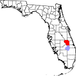
| Okeechobee | ओकीचोबी काउन्ति | 093 | ओकीचोबी, फ्लोरिडा | 1917 | Osceola and Brevard counties | Lake Okeechobee, which was in turn is from the Hitchiti words for "big water" | 51.86 | ४०,१४० | ७७४ sq mi (२,००५ km2) |
|
| Orange | अरेन्ज काउन्ति | 095 | अरल्यान्दो, फ्लोरिदा | 1824 | St. Johns County | The fruit that was the county's main product | 1287.56 | १,१६९,१०७ | ९०८ sq mi (२,३५२ km2) |

|
| Osceola | अस्कियोला काउन्ति | 097 | किसिमे, फ्लोरिडा | 1887 | Brevard and Orange counties | Osceola (1804–1838), a leader of the Seminole during the Second Seminole War | 208.90 | २७६,१६३ | १,३२२ sq mi (३,४२४ km2) |

|
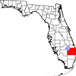
| Palm Beach | पाम बीच काउन्ति | 099 | वेस्ट पाम बीच, फ्लोरिडा | 1909 | Miami-Dade County | The county's large amounts of palm trees | 656.43 | १,३३५,१८७ | २,०३४ sq mi (५,२६८ km2) |
|
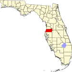
| Pasco | पास्को काउन्ति | 101 | डाडे सिटी, फ्लोरिडा | 1887 | Hernando County | Samuel Pasco (1834–1917), United States Senator at the time of creation of the county | 626.12 | ४६६,४५७ | ७४५ sq mi (१,९३० km2) |
|
| Pinellas | पिनेयाज काउन्ति | 103 | क्लियरवाटर, फ्लोरिडा | 1912 | Hillsborough County | From the Spanish Punta Piñal, or "Point of Pines" | 3276.42 | ९१७,३९८ | २८० sq mi (७२५ km2) |

|
| Polk | पोल्क काउन्ति | 105 | बारटो, फ्लोरिडा | 1861 | Brevard and Hillsborough counties | James K. Polk (1795–1849), the 11th President of the United States | 325.06 | ६०९,४९२ | १,८७५ sq mi (४,८५६ km2) |

|
| Putnam | पत्नम काउन्ति | 107 | पालाट्का, फ्लोरिडा | 1849 | Alachua and St. Johns counties | Benjamin A. Putnam (1801–1869), soldier during the Second Seminole War and Floridian legislator | 102.55 | ७४,०४१ | ७२२ sq mi (१,८७० km2) |

|
| St. Johns | सेन्त जन्स काउन्ति | 109 | सेन्त अगस्तिन, फ्लोरिदा | 1821 | One of the two original counties | Name derived from the St. Johns River, which in turn derives its name from San Juan del Puerto | 321.55 | १९५,८२३ | ६०९ sq mi (१,५७७ km2) |

|
| St. Lucie | सेन्त लुसी काउन्ति | 111 | फर्ट पियर्स, फ्लोरिडा | 1905 | Brevard County | Saint Lucy (283–304), the Christian martyr | 490.17 | २८०,३७९ | ५७२ sq mi (१,४८१ km2) |
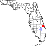
|
| Santa Rosa | सान्ता रोजा काउन्ति | 113 | मिलटन, फ्लोरिडा | 1842 | Escambia County | Santa Rosa Island, which is in turn named for Saint Rosa de Viterbo (1235–1252), a saint born in Viterbo, Italy | 151.68 | १५४,१०४ | १,०१६ sq mi (२,६३१ km2) |

|
| Sarasota | सारासोता काउन्ति | 115 | सारासोटा, फ्लोरिडा | 1921 | Manatee County | Native American word, of uncertain meaning, for the area | 668.20 | ३८२,२१३ | ५७२ sq mi (१,४८१ km2) |

|
| Seminole | सेमिनोल काउन्ति | 117 | स्यान्फर्ड, फ्लोरिडा | 1913 | Orange County | The Seminole Native American tribe | 1380.10 | ४२५,०७१ | ३०८ sq mi (७९८ km2) |

|
| Sumter | सम्तर काउन्ति | 119 | बुशनेल, फ्लोरिडा | 1853 | Orange County | Thomas Sumter (1734–1832), general in the American Revolution | 179.04 | ९७,७५६ | ५४६ sq mi (१,४१४ km2) |

|
| Suwannee | सुवानी काउन्ति | 121 | लाइभ ओक, फ्लोरिडा | 1858 | Columbia County | The Suwannee River, a 266-mile long river in northern Florida | 61.01 | ४१,९७२ | ६८८ sq mi (१,७८२ km2) |

|
| Taylor | तेलर काउन्ति | 123 | पेरी, फ्लोरिडा | 1856 | Madison County | Zachary Taylor (1784–1850), 12th President of the United States | 21.78 | २२,६९१ | १,०४२ sq mi (२,६९९ km2) |
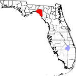
|
| Union | युनियन काउन्ति | 125 | लेक बट्लर, फ्लोरिडा | 1921 | Bradford County | Named for the area's residents united desire to split into a separate county | 64.12 | १५,३८८ | २४० sq mi (६२२ km2) |

|
| Volusia | भोलुसिया काउन्ति | 127 | डे ल्यांड, फ्लोरिडा | 1854 | Orange County | The port of Volusia, whose etymology is uncertain; possibly derived from the Native American word for "Land of the Euchees," the term for the area's native inhabitants | 447.38 | ४९४,८०४ | १,१०६ sq mi (२,८६५ km2) |

|
| Wakulla | वाकुला काउन्ति | 129 | Crawfordville | 1843 | Leon County | The Wakulla River, itself named for a Spanish corruption of a Timucuan word used to describe the body of water, but that is of uncertain meaning | 51.03 | ३०,९७८ | ६०७ sq mi (१,५७२ km2) |
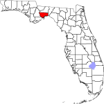
|
| Walton | वाल्तन काउन्ति | 131 | डे फ्युनियाक स्प्रिङ्गस्, फ्लोरिडा | 1824 | Escambia County | George Walton, first Secretary of Florida Territory | 52.73 | ५५,७९३ | १,०५८ sq mi (२,७४० km2) |
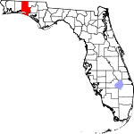
|
| Washington | वासिङ्गतन काउन्ति | 133 | चिपली, फ्लोरिडा | 1825 | Jackson and Walton counties | George Washington (1732–1799), first President of the United States | 42.99 | २४,९३५ | ५८० sq mi (१,५०२ km2) |

|
लिधंसा
[सम्पादन]- ↑ United States Environmental Protection Agency (EPA) County FIPS Code Listing. United States Environmental Protection Agency. April 24, 2008 कथं।
- ↑ २.० २.१ NACo – Find a county. National Association of Counties. April 24, 2008 कथं। [dead link]
- ↑ ३.० ३.१ ३.२ Florida County Maps. Florida Center for Instructional Technology – University of South Florida. January 16, 2010 कथं।
- ↑ Florida QuickFacts from the US Census Bureau. United States Census Bureau. August 19, 2012 कथं।
- ↑ Cite error: Invalid
<ref>tag; no text was provided for refs namedcen - ↑ ६.० ६.१ Eriksen, John M., Brevard County, Florida...A Short History to 1955
