
किपा:Map of Indiana highlighting Brown County.svg

Size of this PNG preview of this SVG file: ३९१ × ५९९ pixels. Other resolutions: १५६ × २४० pixels | ३१३ × ४८० pixels | ५०१ × ७६८ pixels | ६६८ × १,०२४ pixels | १,३३७ × २,०४८ pixels | २,८८७ × ४,४२३ pixels.
Original file (SVG file, nominally २,८८७ × ४,४२३ pixels, file size: ५६ KB)
Summary
| Description |
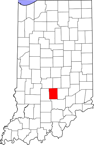
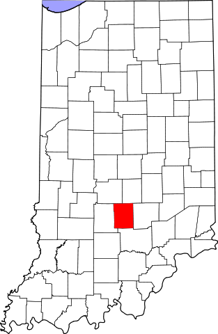
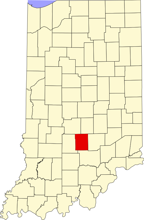
English: This is a locator map showing Brown County in Indiana. For more information, see Commons:United States county locator maps. |
| Date | |
| Source |
Own work: English: The maps use data from nationalatlas.gov, specifically countyp020.tar.gz on the Raw Data Download page. The maps also use state outline data from statesp020.tar.gz. The Florida maps use hydrogm020.tar.gz to display Lake Okeechobee. |
| Author | David Benbennick |
Licensing
| I, the copyright holder of this work, release this work into the public domain. This applies worldwide. In some countries this may not be legally possible; if so: I grant anyone the right to use this work for any purpose, without any conditions, unless such conditions are required by law. |
File history
Click on a date/time to view the file as it appeared at that time.
| Date/Time | Thumbnail | Dimensions | छ्य्लामि | Comment | |
|---|---|---|---|---|---|
| current | १२:०९, १२ फेब्रुवरी २००६ | | २,८८७ × ४,४२३ (५६ KB) | David Benbennick | {{subst:User:Dbenbenn/clm|county=Brown County|state=Indiana}} |
File usage
The following 2 pages use this file:
Global file usage
The following other wikis use this file:
- Usage on ar.wikipedia.org
- Usage on azb.wikipedia.org
- Usage on bg.wikipedia.org
- Usage on bpy.wikipedia.org
- Usage on cdo.wikipedia.org
- Usage on ceb.wikipedia.org
- Usage on ce.wikipedia.org
- Usage on cy.wikipedia.org
- Usage on de.wikipedia.org
- Usage on en.wikipedia.org
- List of counties in Indiana
- Brown County, Indiana
- Nashville, Indiana
- Gnaw Bone, Indiana
- Weed Patch Hill
- Knobstone Escarpment
- Belmont, Indiana
- Beanblossom, Indiana
- Hamblen Township, Brown County, Indiana
- Jackson Township, Brown County, Indiana
- Van Buren Township, Brown County, Indiana
- Washington Township, Brown County, Indiana
- Template:Brown County, Indiana
- Template:BrownCountyIN-geo-stub
- Christiansburg, Indiana
- Clarksdale, Indiana
- Cornelius, Indiana
- Elkinsville, Indiana
- Fruitdale, Indiana
- Gatesville, Indiana
- Taggart, Indiana
- Lanam, Indiana
- Mount Liberty, Indiana
- Needmore, Brown County, Indiana
- Pikes Peak, Indiana
- Spearsville, Indiana
- Stone Head, Indiana
View more global usage of this file.