
किपा:Indus river.svg

Size of this PNG preview of this SVG file: ५५५ × ६०० pixels. Other resolutions: २२२ × २४० pixels | ४४४ × ४८० pixels | ७११ × ७६८ pixels | ९४८ × १,०२४ pixels | १,८९५ × २,०४८ pixels | २,३०९ × २,४९५ pixels.
Original file (SVG file, nominally २,३०९ × २,४९५ pixels, file size: १७२ KB)
https://iasbaba.com/wp-content/uploads/2023/01/Indus-Waters-Treaty.png.webp
Summary
| Description |
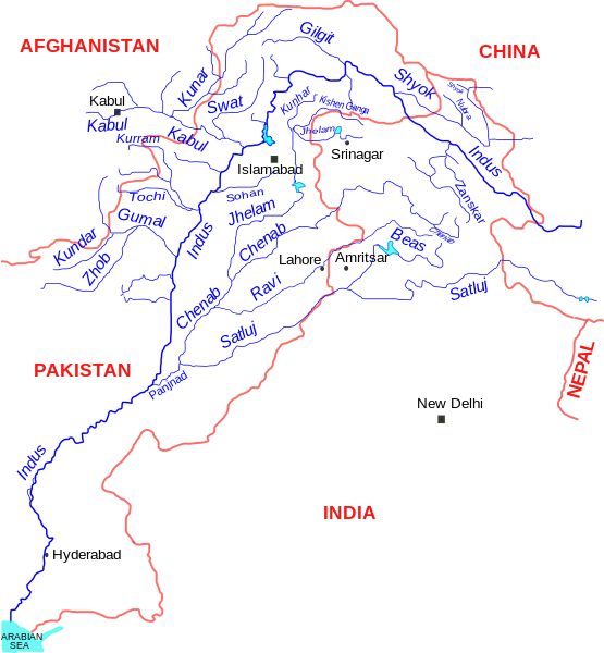
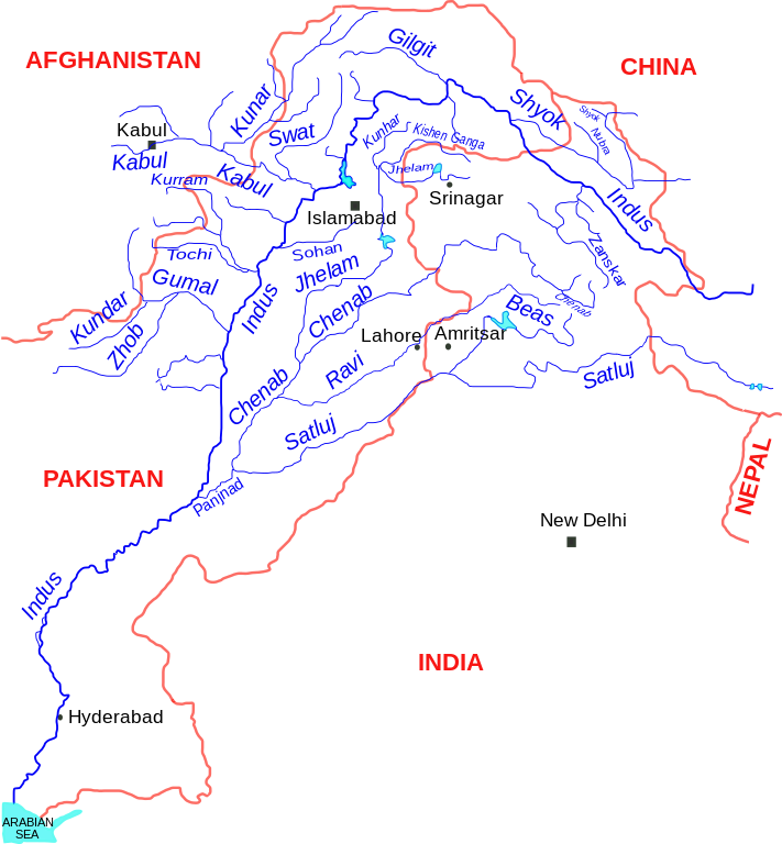
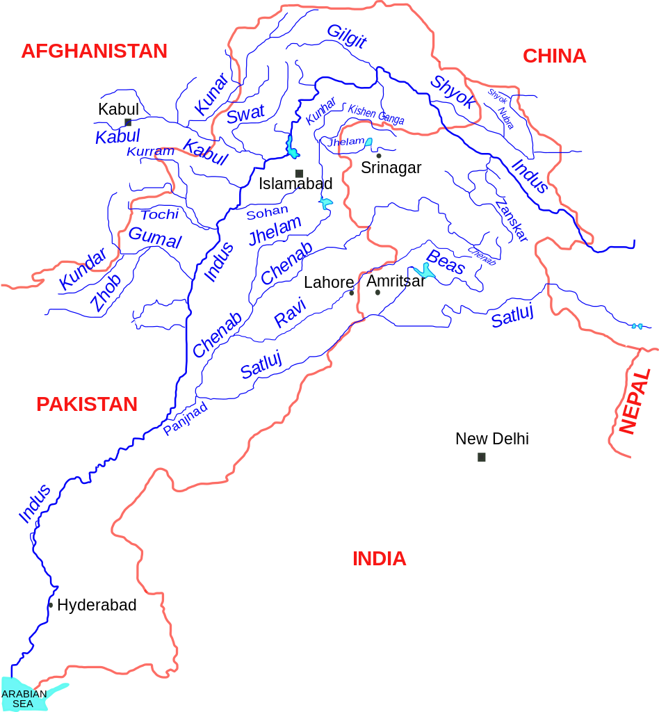
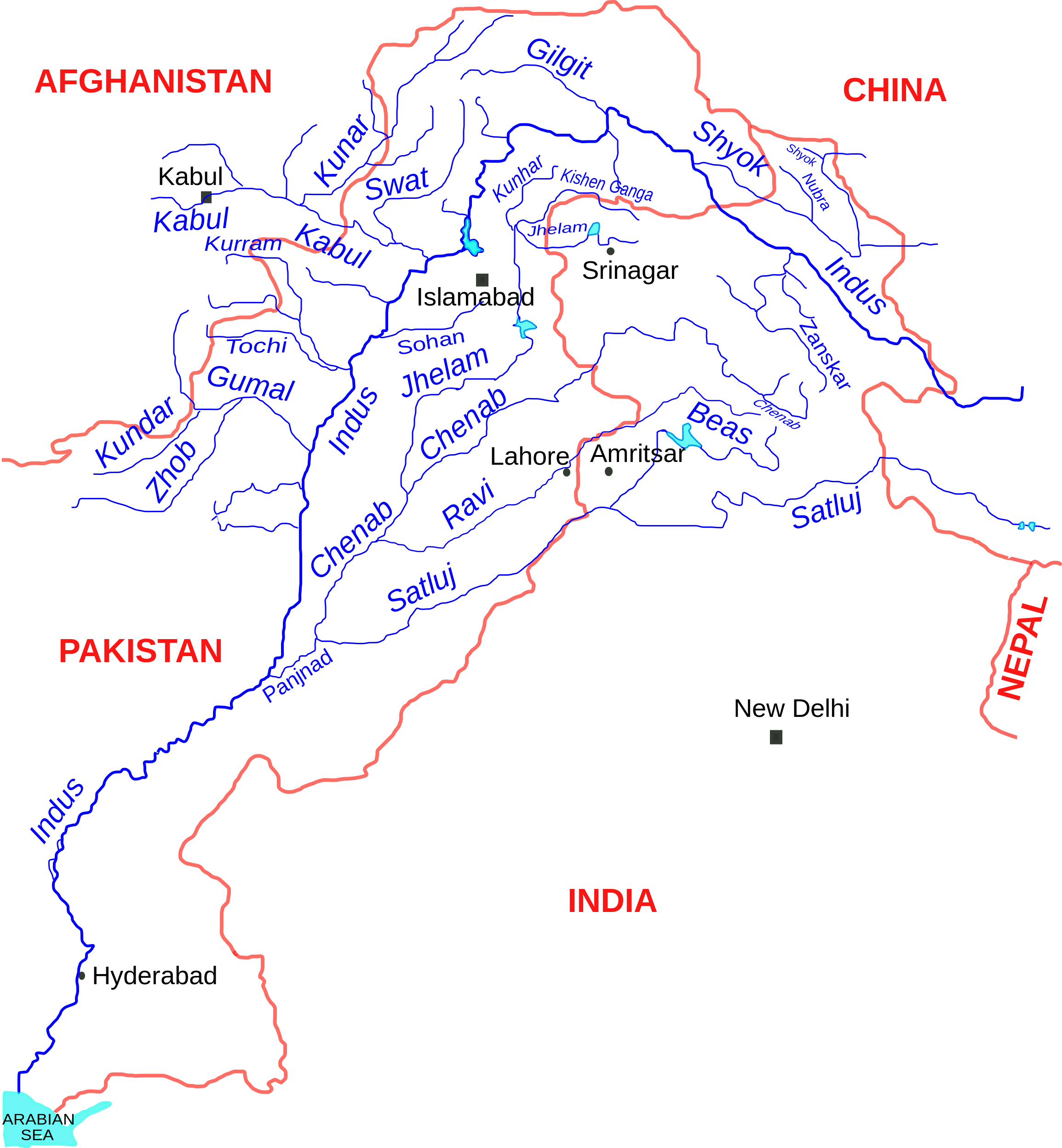
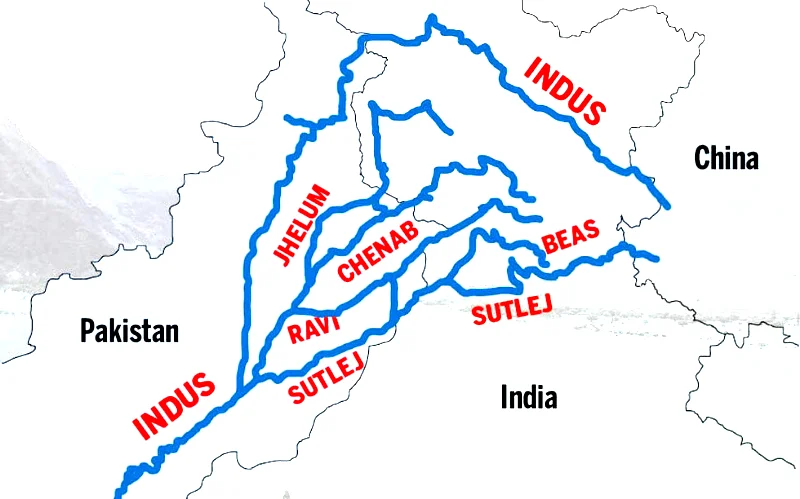
English: Indus river and tributaries, data based on The Times Atlas of the world (Family edition) |
| Date | |
| Source | Own work |
| Author | Kmhkmh |
Licensing
I, the copyright holder of this work, hereby publish it under the following license:
This file is licensed under the Creative Commons Attribution 3.0 Unported license.
- You are free:
- to share – to copy, distribute and transmit the work
- to remix – to adapt the work
- Under the following conditions:
- attribution – You must give appropriate credit, provide a link to the license, and indicate if changes were made. You may do so in any reasonable manner, but not in any way that suggests the licensor endorses you or your use.
| Warning! According to Indian law, it is illegal to produce maps that in the view of the Indian government, misrepresent Indian territories by showing areas the Indian government claims ownership of but does not control as not belonging to India or as being contested. |
File history
Click on a date/time to view the file as it appeared at that time.
| Date/Time | Thumbnail | Dimensions | छ्य्लामि | Comment | |
|---|---|---|---|---|---|
| current | ११:१९, ११ सेप्टेम्बर २०१७ | | २,३०९ × २,४९५ (१७२ KB) | Kmhkmh | minor tweaks |
| २०:०४, २४ जुलाई २०१५ |  | २,३०९ × २,४९५ (१७३ KB) | Kmhkmh | the the modification is not correct and only depicting the _temporary_ flow of floodwaters | |
| १७:५५, २४ अप्रिल २०१५ |  | २,३०९ × २,४९५ (१८२ KB) | RaviC | Rough redrawing of new southern pathway found. Source: http://indiatoday.intoday.in/story/indus-river-re-enters-india/1/158976.html | |
| १०:२३, १ जुन २००९ |  | २,३०९ × २,४९५ (१७३ KB) | Kmhkmh | few details added | |
| १०:३२, ३० मे २००९ |  | २,२८५ × २,४९५ (१५१ KB) | Kmhkmh | few detailes added | |
| २२:१३, २९ मे २००९ |  | २,२८५ × २,४९५ (१२१ KB) | Kmhkmh | {{Information |Description={{en|1=Indus river and tributaries}} |Source=Own work by uploader |Author=Kmhkmh |Date=2009-5-29 |Permission= |other_versions= }} <!--{{ImageUpload|full}}--> |
File usage
The following page uses this file:
Global file usage
The following other wikis use this file:
- Usage on af.wikipedia.org
- Usage on als.wikipedia.org
- Usage on am.wikipedia.org
- Usage on ar.wikipedia.org
- Usage on ast.wikipedia.org
- Usage on as.wikipedia.org
- Usage on awa.wikipedia.org
- Usage on azb.wikipedia.org
- Usage on ba.wikipedia.org
- Usage on be.wikipedia.org
- Usage on bg.wikipedia.org
- Usage on bh.wikipedia.org
- Usage on bn.wikipedia.org
- Usage on ca.wikipedia.org
- Usage on ceb.wikipedia.org
- Usage on ce.wikipedia.org
- Usage on ckb.wikipedia.org
- Usage on cs.wikipedia.org
- Usage on da.wikipedia.org
View more global usage of this file.