
किपा:Bihar district location map Bhagalpur.svg

Size of this PNG preview of this SVG file: ७८१ × ६०० pixels. Other resolutions: ३१३ × २४० pixels | ६२५ × ४८० pixels | १,००० × ७६८ pixels | १,२८० × ९८३ pixels | २,५६० × १,९६६ pixels | ९८३ × ७५५ pixels.
Original file (SVG file, nominally ९८३ × ७५५ pixels, file size: ८०९ KB)
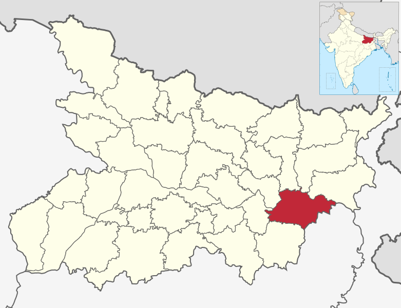
| Description | Map showing location of district in Bihar in India |
| Date | |
| Source | own work based on image:Bihar locator map.svg |
| Author | User:Haros based on map created by user:Planemad |
| Permission (Reusing this file) |
Own work, attribution required (Multi-license with GFDL and Creative Commons CC-BY 3.0) |
I, the copyright holder of this work, hereby publish it under the following licenses:
This file is licensed under the Creative Commons Attribution-Share Alike 3.0 Unported license.
- You are free:
- to share – to copy, distribute and transmit the work
- to remix – to adapt the work
- Under the following conditions:
- attribution – You must give appropriate credit, provide a link to the license, and indicate if changes were made. You may do so in any reasonable manner, but not in any way that suggests the licensor endorses you or your use.
- share alike – If you remix, transform, or build upon the material, you must distribute your contributions under the same or compatible license as the original.

|
Permission is granted to copy, distribute and/or modify this document under the terms of the GNU Free Documentation License, Version 1.2 or any later version published by the Free Software Foundation; with no Invariant Sections, no Front-Cover Texts, and no Back-Cover Texts. A copy of the license is included in the section entitled GNU Free Documentation License. |
You may select the license of your choice.
File history
Click on a date/time to view the file as it appeared at that time.
| Date/Time | Thumbnail | Dimensions | छ्य्लामि | Comment | |
|---|---|---|---|---|---|
| current | ०२:५३, २४ अगस्ट २०२१ | | ९८३ × ७५५ (८०९ KB) | C1MM | c inset map |
| १५:५१, २२ अगस्ट २०२१ |  | ९८३ × ७५५ (८०९ KB) | C1MM | c bounds | |
| ०६:१०, १० फेब्रुवरी २०२१ |  | ९८३ × ७५५ (३०० KB) | C1MM | Updated boundaries | |
| २३:५१, ११ नोभेम्बर २००८ |  | १,६१४ × १,९१५ (२५६ KB) | Haros | {{Information |Description=Map showing location of district in Bihar in India |Source=own work based on image:Bihar locator map.svg |Date=2008-11-12 |Author=User:Haros based on map created by user:Planemad |Permission=Own work, attribution r |
File usage
The following page uses this file:
Global file usage
The following other wikis use this file:
- Usage on anp.wikipedia.org
- Usage on bh.wikipedia.org
- Usage on bn.wikipedia.org
- Usage on ca.wikipedia.org
- Usage on ceb.wikipedia.org
- Usage on de.wikipedia.org
- Usage on en.wikipedia.org
- Usage on es.wikipedia.org
- Usage on eu.wikipedia.org
- Usage on fa.wikipedia.org
- Usage on fr.wikipedia.org
- Usage on hif.wikipedia.org
- Usage on hi.wikipedia.org
- Usage on incubator.wikimedia.org
- Usage on mr.wikipedia.org
- Usage on ne.wikipedia.org
- Usage on nl.wikipedia.org
- Usage on no.wikipedia.org
- Usage on oc.wikipedia.org
- Usage on pa.wikipedia.org
- Usage on pnb.wikipedia.org
- Usage on pt.wikipedia.org
- Usage on ru.wikipedia.org
- Usage on sat.wikipedia.org
- Usage on sa.wikipedia.org
- Usage on simple.wikipedia.org
- Usage on sv.wikipedia.org
- Usage on ta.wikipedia.org
- Usage on te.wikipedia.org
- Usage on ur.wikipedia.org
View more global usage of this file.