
किपा:BD Map admin.svg

Size of this PNG preview of this SVG file: ४२९ × ५९९ pixels. Other resolutions: १७२ × २४० pixels | ३४४ × ४८० pixels | ५५० × ७६८ pixels | ७३३ × १,०२४ pixels | १,४६६ × २,०४८ pixels | १,५३१ × २,१३८ pixels.
Original file (SVG file, nominally १,५३१ × २,१३८ pixels, file size: १०० KB)
Summary
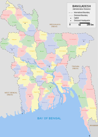
| Description | Administrative Map of Bangladesh |
| Date | |
| Source | Own work |
| Author | Armanaziz |
| Other versions |
|
| SVG genesis | This map was created with Adobe Illustrator. |


While creating this map I have drawn inspiration and reference from works of Rarelibra (here) and Usingha (here) and several online maps:LGED, GoB archive copy at the Wayback Machine, Banglapedia. Armanaziz 08:41, 30 July 2007 (UTC)
Licensing
I, Armanaziz, the copyright holder of this work, hereby publishes it under the following licenses:

|
Permission is granted to copy, distribute and/or modify this document under the terms of the GNU Free Documentation License, Version 1.2 or any later version published by the Free Software Foundation; with no Invariant Sections, no Front-Cover Texts, and no Back-Cover Texts. A copy of the license is included in the section entitled GNU Free Documentation License. |
| This file is licensed under the Creative Commons Attribution-Share Alike 3.0 Unported license. | ||
| Attribution: I, Armanaziz | ||
| ||
| This licensing tag was added to this file as part of the GFDL licensing update. |
This file is licensed under the Creative Commons Attribution 2.5 Generic license.
Attribution: I, Armanaziz
- You are free:
- to share – to copy, distribute and transmit the work
- to remix – to adapt the work
- Under the following conditions:
- attribution – You must give appropriate credit, provide a link to the license, and indicate if changes were made. You may do so in any reasonable manner, but not in any way that suggests the licensor endorses you or your use.
You may select the license of your choice.
File history
Click on a date/time to view the file as it appeared at that time.
| Date/Time | Thumbnail | Dimensions | छ्य्लामि | Comment | |
|---|---|---|---|---|---|
| current | ११:४५, १४ ज्यानुवरी २०२३ | | १,५३१ × २,१३८ (१०० KB) | Rohonk1 | Added the Division of Mymensingh |
| ०८:२५, २१ अक्टोबर २०१४ |  | १,५३१ × २,१३८ (९४ KB) | Nafsadh | border color | |
| ०८:२२, २१ अक्टोबर २०१४ |  | १,५३१ × २,१३८ (९४ KB) | Nafsadh | outside color | |
| ०५:१९, १७ डिसेम्बर २०१३ |  | १,५३१ × २,१३८ (१५० KB) | Wereldburger758 | added Divisional Boundary for Rangpur Division & added Bullet ( • ) for Rangpur District | |
| ०८:४१, ३० जुलाई २००७ |  | १,५३१ × २,१३८ (२०८ KB) | Armanaziz | {{Information |Description=Administrative Map of Bangladesh |Source=self-made |Date=2007-07-30 |Author= Armanaziz }} While creating this map I have drawn inspiration and reference from works of Rarelibra ([[:Image:Ba |
File usage
The following page uses this file:
Global file usage
The following other wikis use this file:
- Usage on ar.wikipedia.org
- Usage on azb.wikipedia.org
- Usage on el.wikipedia.org
- Usage on en.wikipedia.org
- Usage on es.wikipedia.org
- Usage on fa.wikipedia.org
- Usage on fr.wikipedia.org
- Usage on ja.wikipedia.org
- Usage on ka.wikipedia.org
- Usage on ko.wikipedia.org
- Usage on ne.wikipedia.org
- Usage on nl.wikipedia.org
- Usage on pa.wikipedia.org
- Usage on pnb.wikipedia.org
- Usage on pt.wikipedia.org
- Usage on ru.wikipedia.org
- Usage on simple.wikipedia.org
- Usage on su.wikipedia.org
- Usage on uk.wikipedia.org
- Usage on ur.wikipedia.org
- Usage on zh.wikipedia.org