
किपा:Asylum Township.jpg
Size of this preview: ८०० × ४९४ pixels. Other resolutions: ३२० × १९७ pixels | ६४० × ३९५ pixels | १,०२४ × ६३२ pixels | १,२८० × ७९० pixels | २,५६० × १,५७९ pixels | ३,७१७ × २,२९३ pixels.
Original file (३,७१७ × २,२९३ pixels, file size: ६.८८ MB, MIME type: image/jpeg)
| Description |
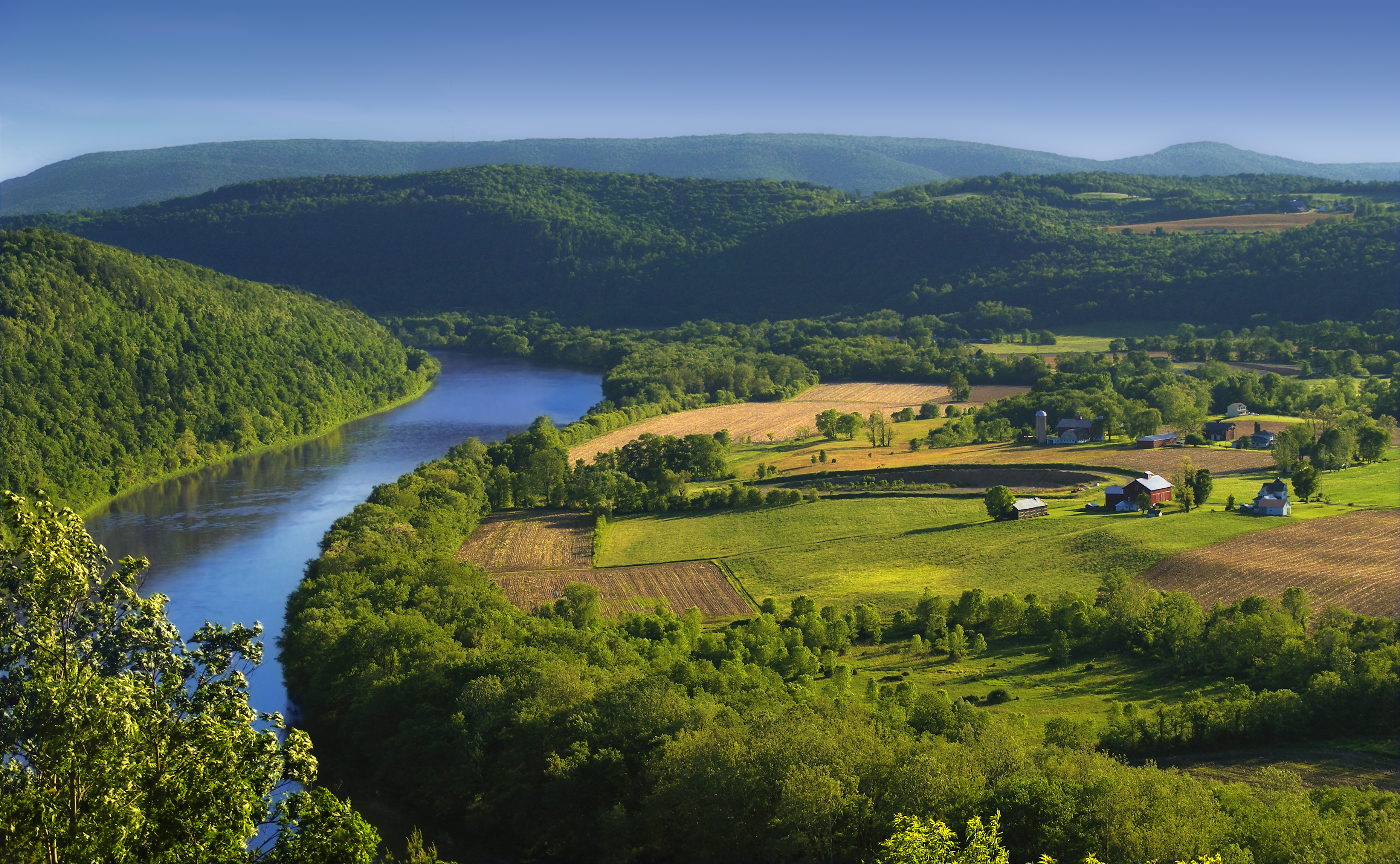
English: The Susquehanna River, Asylum Township, Bradford County, as seen from the Marie Antoinette Lookout off of US Route 6 near Wyalusing in Pennsylvania. Visible from here is the French Azilum Historic Site, where some Revolution-fleeing French aristocrats settled in 1793. It was said that Marie Antoinette planned to settle in a house across the river from the lookout which was allegedly built for her. The marker reads: A settlement of French royalists, who fled the French Revolution in 1793, was established in the valley directly opposite this marker. It was laid out and settled under the direction of Viscount de Noailles and Marquis Antoine Omer Talon. It was hoped that Queen Marie Antoinette might here find safety. Marie Antoinette Lookout, Route 6, Wyalusing, PA. |
||
| Date | |||
| Source | https://www.flickr.com/photos/nicholas_t/3594274494/ | ||
| Author | Nicholas A. Tonelli from Northeast Pennsylvania, USA | ||
| Permission (Reusing this file) |
|
| Camera location | | View this and other nearby images on: OpenStreetMap |
|---|
Licensing
This file is licensed under the Creative Commons Attribution 2.0 Generic license.
- You are free:
- to share – to copy, distribute and transmit the work
- to remix – to adapt the work
- Under the following conditions:
- attribution – You must give appropriate credit, provide a link to the license, and indicate if changes were made. You may do so in any reasonable manner, but not in any way that suggests the licensor endorses you or your use.
File history
Click on a date/time to view the file as it appeared at that time.
| Date/Time | Thumbnail | Dimensions | छ्य्लामि | Comment | |
|---|---|---|---|---|---|
| current | ००:४९, ६ जुन २००९ | | ३,७१७ × २,२९३ (६.८८ MB) | Flickr upload bot | Uploaded from http://flickr.com/photo/14922165@N00/3594274494 using Flickr upload bot |
File usage
The following page uses this file:
Global file usage
The following other wikis use this file:
- Usage on ar.wikipedia.org
- Usage on azb.wikipedia.org
- Usage on cy.wikipedia.org
- Usage on da.wikipedia.org
- Usage on en.wikipedia.org
- Usage on eo.wikipedia.org
- Usage on es.wikipedia.org
- Usage on fi.wikipedia.org
- Usage on fr.wikipedia.org
- Usage on fy.wikipedia.org
- Usage on hu.wikipedia.org
- Usage on id.wikipedia.org
- Usage on it.wikipedia.org
- Usage on ko.wikipedia.org
- Usage on ml.wikipedia.org
- Usage on ms.wikipedia.org
- Usage on sl.wikipedia.org
- Usage on sr.wikipedia.org
- Usage on sv.wikipedia.org
- Usage on th.wikipedia.org
- Usage on tl.wikipedia.org
- Usage on tr.wikipedia.org
- Usage on uk.wikipedia.org
- Usage on vi.wikipedia.org
- Usage on www.wikidata.org
- Usage on xmf.wikipedia.org
- Usage on zh.wikipedia.org