श्रीलङ्काया प्रशासनिक विभाजन
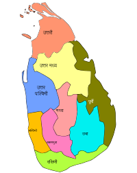
प्रशासकीय रूपय् श्रीलंका ९ प्रन्तय् विभक्त दु। थ्व ९ प्रान्तय् सकल २५ जिल्ला दु। थ्व जिल्लाया तहत मण्डलीय सचिवालय दु व इमिगु घटक इकाईयात ग्राम सेवक खण्ड धाइ।
| प्रान्त | राजधानी | जिल्ला | |
|---|---|---|---|
| १ | मध्यम | क्याण्डी | क्याण्डी, मातले, नुवर एलिय |
| २ | उतुरु मेद | अनुराधपुर | अनुराधपुर, पोलोन्नारुव |
| ३ | उतुरु | जाफना | जाफना, किलिनोच्चि, मन्नार , वावुनिया, मुलैतिवु |
| ४ | नेगेनहिर | त्रिंकोन्माली | अम्पार, बट्टिकलोआ , त्रिंकोन्माली |
| ५ | वयँब | कुरुनेगल | कुरुनेगल, पुत्तलम |
| ६ | दकुणु | गाल्ल | गाल्ल, हम्बन्तोट, मातर |
| ७ | ऊव | बदुल्ल | बदुल्ल, मोनरागल |
| ८ | सबरगमुव | रतनपुर, श्रीलङ्का, रतनपुर | केगल्ल, रतनपुर |
| ९ | बस्नाहिर | कोलम्बो | कोलम्बो, गम्पहा, कलुतर |
जिल्ला[सम्पादन]
सन् २००१स जनगणना कथं श्रीलङ्काया जिल्लातेगु जनसंख्या थ्व कथं दु
| ल्या | नां | मानकिपा | प्रान्त | राजधानी | मू नगरय | भूमि (किमि) | जल (किमि) | सकल क्षेत्रफल | जनसंख्या | जनघनत्व (प्रति वर्ग किमि) |
|---|---|---|---|---|---|---|---|---|---|---|
| १६ | अम्पार | 
|
नॅगॆनहिर प्रान्त | अम्पार | अम्पार | ४२२२ | १९३ | ४४१५ | ५९२,९९७ | १५३ |
| २० | अनुराधपुर | 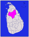
|
उतुरु मॅद प्रान्त | अनुराधपुर नव नगर | अनुराधपुर नव नगर | ६६६४ | ५१५ | ७१७९ | ७४५,६९३ | १२८ |
| २२ | बदुल्ल | 
|
ऊव प्रान्त | बदुल्ल | बदुल्ल | २८२७ | ३४ | २८६१ | ७७९,९८३ | २८७ |
| १५ | मडकलपुव | 
|
नॅगॆनहिर प्रान्त | मडकलपुव | मडकलपुव | २६१० | २४४ | २८५४ | ४८६,४४७ * | २०१ |
| १ | कोलम्बो | 
|
बस्नाहिर प्रान्त | कोलम्बो | कोलम्बो | ६७६ | २३ | ६९९ | २,२५१,२७४ | ३४१७ |
| ७ | गाल्ल | 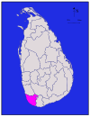
|
दकुणु प्रान्त | गाल्ल | गाल्ल | १६१७ | ३५ | १६५२ | ९९०,४८७ | ६६५ |
| २ | गम्पह | 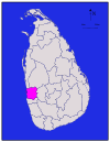
|
बस्नाहिर प्रान्त | गम्पह | मीगमुव | १३४१ | ४६ | १३८७ | २,०६३,६८४ | १७११ |
| ९ | हम्बन्तोट | 
|
दकुणु प्रान्त | हम्बन्तॊट | हम्बन्तॊट | २४९६ | ११३ | २६०९ | ५२६,४१४ | २३९ |
| १० | जाफना | 
|
उतुरु प्रान्त | यापनय | यापनय | ९२९ | ९६ | १०२५ | ४९०,६२१ * | ६२८ |
| ३ | कळुतर | 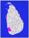
|
बस्नाहिर प्रान्त | कळुतर | पानदुर | १५७६ | २२ | १५९८ | १,०६६,२३९ | ७७२ |
| ४ | महनुवर (क्यान्दि) | 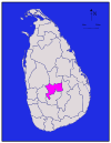
|
मध्यम प्रान्त | महनुवर | महनुवर | १९१७ | २३ | १९४० | १,२७९,०२८ | ७१५ |
| २५ | कॅगल्ल | 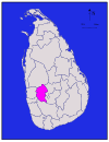
|
सबरगमुव प्रान्त | कॅगल्ल | कॅगल्ल | १६८५ | ८ | १६९३ | ७८५,५२४ | ४९७ |
| ११ | किलिनॊच्चि | 
|
उतुरु प्रान्त | किलिनॊच्चिय | किलिनॊच्चिय | १२०५ | ७४ | १२७९ | १२७,२६३ * | ९४ |
| १८ | कुरुणॅगल | 
|
वयँब प्रान्त | कुरुणॅगल | कुरुणॅगल | ४६२४ | १९२ | ४८१६ | १,४६०,२१५ | ३४८ |
| १२ | मन्नारम | 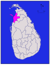
|
उतुरु प्रान्त | मन्नारम | मन्नारम | १८८० | ११६ | १९९६ | १५१,५७७ * | ५३ |
| ५ | मातले | 
|
मध्यम प्रान्त | मातले | मातले | १९५२ | ४१ | १९९३ | ४४१,३२८ | २४७ |
| ८ | मातर | 
|
दकुणु प्रान्त | मातर | मातर | १२७० | १३ | १२८३ | ७६१,३७० | ६३७ |
| २३ | मॊणरागल | 
|
ऊव प्रान्त | मॊणरागल | मॊणरागल | ५५०८ | १३१ | ५६३९ | ३९७,३७५ | ८१ |
| १४ | मुलतिव् | 
|
उतुरु प्रान्त | मुलतिव् | मुलतिव् | २४१५ | २०२ | २६१७ | १२१,६६७ * | ३८ |
| ६ | नुवरऎळिय | 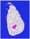
|
मध्यम प्रान्त | नुवरऎळिय | नुवरऎळिय | १७०६ | ३५ | १७४१ | ७०३,६१० | ४१४ |
| २१ | पॊळॊन्नरुव | 
|
उतुरु मॅद प्रान्त | पॊळॊन्नरुव | कदुरुवॆल | ३०७७ | २१६ | ३२९३ | ३५८,९८४ | १३१ |
| १९ | पुत्तलम | 
|
वयँब प्रान्त | पुत्तलम | हलावत | २८८२ | १९० | ३०७२ | ७०९,६७७ | २६४ |
| २४ | रत्नपुर | 
|
सबरगमुव प्रान्त | रत्नपुर | रत्नपुर | ३२३६ | ३९ | ३२७५ | १,०१५,८०७ | ३३४ |
| १७ | त्रिकुणामलय | 
|
नॅगॆनहिर प्रान्त | त्रिकुणामलय | त्रिकुणामलय | २५२९ | १९८ | २७२७ | ३४०,१५८ * | १५० |
| १३ | ववुनियाव | 
|
उतुरु प्रान्त | ववुनियाव | ववुनियाव | १८६१ | १०६ | १९६७ | १४९,८३५ * | ९२ |
लिधंसा[सम्पादन]
स्वयादिसँ[सम्पादन]
| ||||||||||||||||||||||||||||||||||||||||
