
किपा:Map of North Carolina NA.png
Size of this preview: ७७६ × ६०० pixels. Other resolutions: ३११ × २४० pixels | ६२१ × ४८० pixels | ९९४ × ७६८ pixels | १,२८० × ९८९ pixels | २,१२२ × १,६४० pixels.
Original file (२,१२२ × १,६४० pixels, file size: १.२१ MB, MIME type: image/png)
Summary
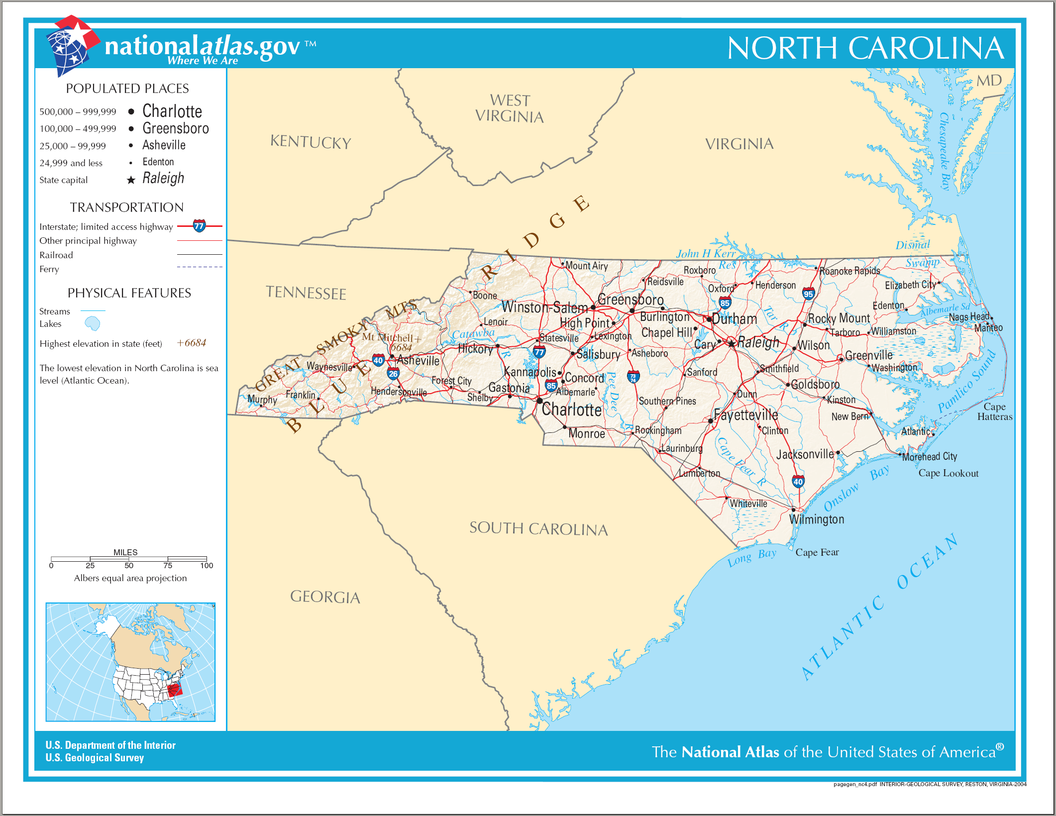
| Description | Map of North Carolina |
| Date | |
| Source | National Atlas |
| Author | US Department of the Interior |
Licensing
This map was obtained from an edition of the National Atlas of the United States. Like almost all works of the U.S. federal government, works from the National Atlas are in the public domain in the United States.
Online access: NationalAtlas.gov | 1970 print edition: Library of Congress, Perry-Castañeda Library
|
File history
Click on a date/time to view the file as it appeared at that time.
| Date/Time | Thumbnail | Dimensions | छ्य्लामि | Comment | |
|---|---|---|---|---|---|
| current | २१:३७, १४ अगस्ट २००६ | | २,१२२ × १,६४० (१.२१ MB) | Huebi~commonswiki | {{Information| |Description=Map of North Carolina |Source=[http://www.nationalatlas.gov National Atlas] }} Category:Maps of the United States Category:Maps of North Carolina {{PD-USGov-Atlas}} |
File usage
The following page uses this file:
Global file usage
The following other wikis use this file:
- Usage on ast.wikipedia.org
- Usage on be.wikipedia.org
- Usage on de.wikipedia.org
- Usage on el.wikipedia.org
- Usage on en.wikipedia.org
- Usage on eo.wikipedia.org
- Usage on fi.wikipedia.org
- Usage on fr.wikipedia.org
- Usage on hr.wiktionary.org
- Usage on hu.wikipedia.org
- Usage on incubator.wikimedia.org
- Usage on it.wikipedia.org
- Usage on ja.wikipedia.org
- Usage on lt.wikipedia.org
- Usage on szl.wikipedia.org
- Usage on zea.wikipedia.org
- Usage on zh.wikipedia.org