
किपा:Karst following phosphate mining on Nauru.jpg
Size of this preview: ८०० × ५३५ pixels. Other resolutions: ३२० × २१४ pixels | ६४० × ४२८ pixels | १,०२४ × ६८४ pixels | १,२८० × ८५५ pixels | १,७८७ × १,१९४ pixels.
Original file (१,७८७ × १,१९४ pixels, file size: ८३५ KB, MIME type: image/jpeg)
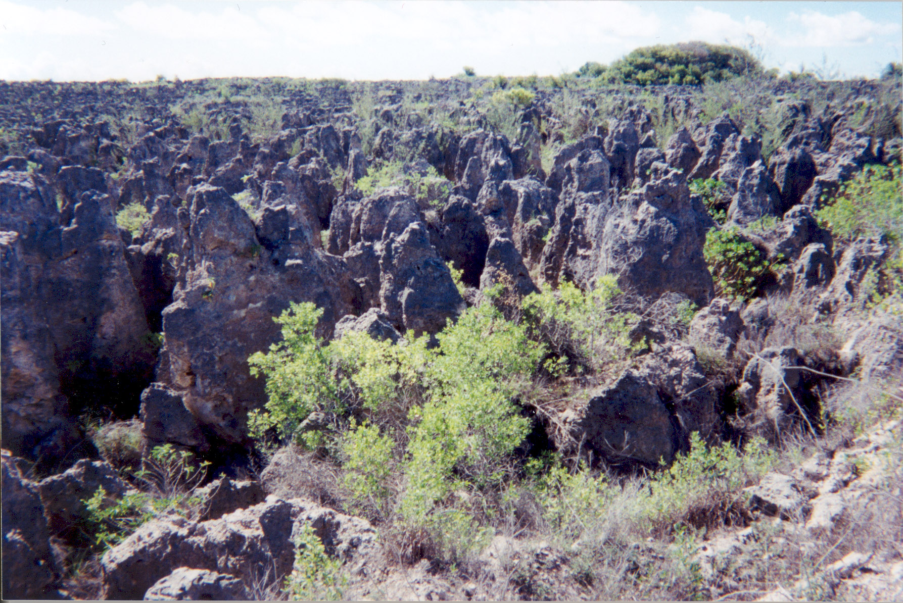
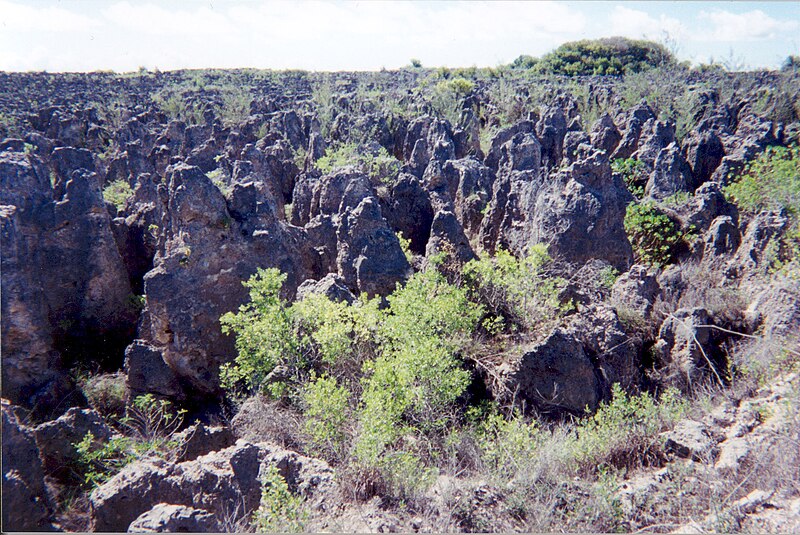
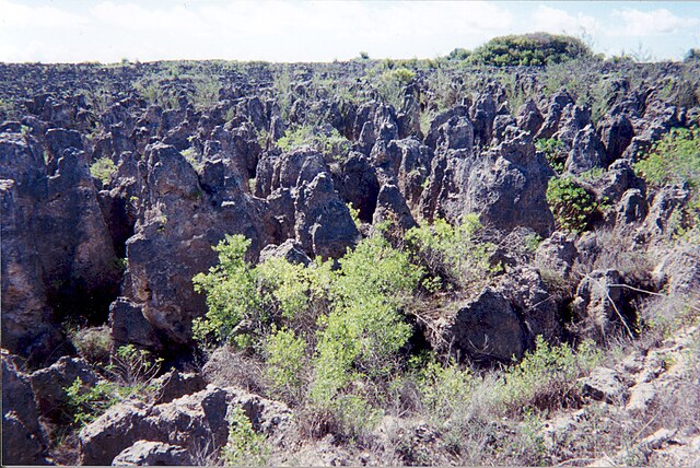
A limestone karst on Nauru Island as a result of the over-mining of phosphate.
Source: [1] (http://www.arm.gov/)
This photograph was produced by the Atmospheric Radiation Measurement Program.
Their site states:
|
File history
Click on a date/time to view the file as it appeared at that time.
| Date/Time | Thumbnail | Dimensions | छ्य्लामि | Comment | |
|---|---|---|---|---|---|
| current | ०२:१०, ३ अप्रिल २००७ | | १,७८७ × १,१९४ (८३५ KB) | Indolences | |
| ०५:२१, ५ मे २००६ |  | ४८० × ३२१ (७५ KB) | PDH | Nauruan districts of Denigomodu and Nibok. ''Courtesy: U.S. Department of Energy's Atmospheric Radiation Measurement Program.'' Source: [http://images.arm.gov/armimages.nsf/a89ad461c472386388256cf3007aeb57/500d8248a90eea9488256cc400727e96?OpenDocument&H |
File usage
The following page uses this file:
Global file usage
The following other wikis use this file:
- Usage on az.wikipedia.org
- Usage on bg.wikipedia.org
- Usage on bh.wikipedia.org
- Usage on ca.wikipedia.org
- Usage on de.wikipedia.org
- Usage on el.wikipedia.org
- Usage on en.wikipedia.org
- Usage on en.wikiquote.org
- Usage on eo.wikipedia.org
- Usage on es.wikipedia.org
- Usage on eu.wikipedia.org
- Usage on fa.wikipedia.org
- Usage on fr.wikipedia.org
- Usage on ha.wikipedia.org
- Usage on he.wikipedia.org
- Usage on id.wikipedia.org
- Usage on ig.wikipedia.org
- Usage on ja.wikipedia.org
- Usage on mk.wikipedia.org
- Usage on mt.wikipedia.org
- Usage on na.wikipedia.org
- Usage on pl.wikipedia.org
- Usage on pt.wikipedia.org
- Usage on ro.wikipedia.org
- Usage on ru.wikipedia.org
- Usage on si.wikipedia.org
- Usage on sv.wikipedia.org
- Usage on tr.wikipedia.org
- Usage on uk.wikipedia.org
- Usage on vi.wikipedia.org
View more global usage of this file.