
किपा:Census Bureau map of Trenton, New Jersey.png
No higher resolution available.
Census_Bureau_map_of_Trenton,_New_Jersey.png (५७५ × ४२५ pixels, file size: ६९ KB, MIME type: image/png)
Summary
| Description |
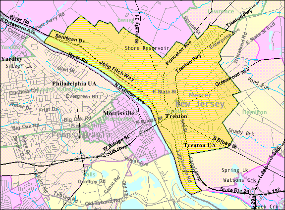
English: Census Bureau map of Trenton |
| Source | [1] |
| Author | United States Census Bureau |
Licensing
This image or file is a work of a United States Census Bureau employee, taken or made as part of that person's official duties. As a work of the U.S. federal government, the image is in the public domain.
|
 |
Original upload log
Transferred from en.wikipedia to Commons by Quadell using CommonsHelper.
The original description page was here. All following user names refer to en.wikipedia.
- 2011-02-08 20:59 Alansohn 575×425× (69525 bytes) {{Information |Description = Census Bureau map of [[Trenton, New Jersey]] |Source = [http://factfinder.census.gov/servlet/MapItDrawServlet?geo_id=16000US3474000&_bucket_id=49&tree_id=339&context=saff&_lang=en&_sse=on] |Date = ~~~~~
Original upload log
| Date/Time | Dimensions | छ्य्लामि | Comment |
|---|---|---|---|
| जुलाइ ४, ई सं २०१३, २०:३८:०७ | 575 × 425 (69525 bytes) | File Upload Bot (Magnus Manske) (खँल्हाबँल्हा · योगदान) | Transfered from en.wikipedia by [[User:Quadell]] using CommonsHelper |
File history
Click on a date/time to view the file as it appeared at that time.
| Date/Time | Thumbnail | Dimensions | छ्य्लामि | Comment | |
|---|---|---|---|---|---|
| current | २१:०५, २० नोभेम्बर २०१४ | | ५७५ × ४२५ (६९ KB) | GifTagger | Bot: Converting file to superior PNG file. (Source: Census_Bureau_map_of_Trenton,_New_Jersey.gif). This GIF was problematic due to non-greyscale color table. |
File usage
The following page uses this file:
Global file usage
The following other wikis use this file:
- Usage on azb.wikipedia.org
- Usage on bn.wikipedia.org
- Usage on en.wikipedia.org
- Usage on fi.wikipedia.org
- Usage on ja.wikipedia.org
- Usage on ml.wikipedia.org
- Usage on simple.wikipedia.org
- Usage on th.wikipedia.org
- Usage on ur.wikipedia.org
- Usage on zh.wikipedia.org