
किपा:Amazonrivermap.png
Size of this preview: ६०० × ६०० pixels. Other resolutions: २४० × २४० pixels | ४८० × ४८० pixels | १,००० × १,००० pixels.
Original file (१,००० × १,००० pixels, file size: ५५१ KB, MIME type: image/png)

|
File:Amazonrivermap.svg is a vector version of this file. It should be used in place of this PNG file when not inferior.
File:Amazonrivermap.png → File:Amazonrivermap.svg
For more information, see Help:SVG. |
 |
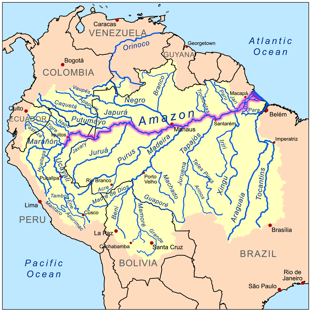
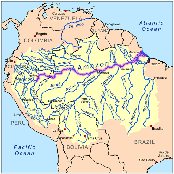
| Description | This is a map of the Amazon River drainage basin with the Amazon River highlighted. |
| Date | |
| Source | Own work using Digital Chart of the World and GTOPO data. |
| Author | Kmusser |
I, the copyright holder of this work, hereby publish it under the following license:
This file is licensed under the Creative Commons Attribution-Share Alike 3.0 Unported license.
- You are free:
- to share – to copy, distribute and transmit the work
- to remix – to adapt the work
- Under the following conditions:
- attribution – You must give appropriate credit, provide a link to the license, and indicate if changes were made. You may do so in any reasonable manner, but not in any way that suggests the licensor endorses you or your use.
- share alike – If you remix, transform, or build upon the material, you must distribute your contributions under the same or compatible license as the original.
File history
Click on a date/time to view the file as it appeared at that time.
| Date/Time | Thumbnail | Dimensions | छ्य्लामि | Comment | |
|---|---|---|---|---|---|
| current | १९:०२, १९ डिसेम्बर २०२२ | | १,००० × १,००० (५५१ KB) | Italyoz484 | |
| १७:०४, १ सेप्टेम्बर २०२२ |  | १,००० × १,००० (५८३ KB) | Wolf170278 | Tocantins doesn't belong to the amazon river basin | |
| १७:१५, ८ सेप्टेम्बर २००८ |  | १,००० × १,००० (५५१ KB) | Kmusser | {{Information |Description=This is a map of the Amazon River drainage basin with the Amazon River highlighted. |Source=Own work using http://www.maproom.psu.edu/dcw/ Digital Chart of the World and [[http://edc.usgs.gov/products/el |
File usage
There are no pages that use this file.
Global file usage
The following other wikis use this file:
- Usage on da.wikipedia.org
- Usage on de.wikipedia.org
- Usage on de.wikinews.org
- Usage on en.wikipedia.org
- Usage on he.wikipedia.org
- Usage on ko.wikipedia.org
- Usage on lez.wikipedia.org
- Usage on nn.wikipedia.org
- Usage on no.wikipedia.org